Day 1: Sunday October 31, 2010: Departure from Belgium
Eventually the day has come. The trip to the other side of the world, to the land of The Lord Of The Rings, to one of the most bea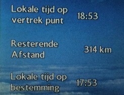 utiful countries in the world, according to some people, to Aotearoa, The Land of the Long White Cloud. I certainly have been looking forward to this trip and I even was a little bit nervous the last couple of days. I am convinced though that everything will be fine. It is one month of vacation and Iím taking this with my best friend, Eef. Weíve been used to going out together for years, so now in these new circumstances all will be all right too.
Patrik and my mother Linda come and pick me up at home in Galgestraat at about three thirty and we leave for Zaventem to start the longest journey of my life: it is a trip to the other side of the world, our antipodes. The first part of the trip is already going well: in less than half an hour weíre at Zaventem. Quickly I smoke a cigarette and we can go. Eef has also arrived; Aagje drove her there. We chat a bit, smoke another one and then we can head for check-in. there are a lot of people at the desk of British Airways flight BA 399 and a frie ndly stewardess gives us through the fast track our boarding passes, for the three flights at once.
Before we really board we enjoy yet another cigarette, because it will take a long time before we can have a smoke. The customs check and the check of the hand luggage are going well and quickly we arrive at gate B4. This is our boarding gate, but currently there still is a flight to Istanbul boarding, so weíll be redirected to another gate probably. We head for a bar, order a Leffe Blonde and drink it at the bar. That tastes very nice. Next to the bar there we spot a place where smoking is allowed, so we stop there quickly and then go to gate B4. The gate has changed and we leave from B27. To that gate and that is the first part of our long journey.
Time is 18:45 and the flight leaves on time: thatís a good start. Itís already dark outside, so we have no use of any window seats,  because you canít recognize anything anyway. This flight is the shortest one of the full range, Brussels Ė London and the pilot takes us to Heathrow International Airport in less than an hour. There we pass the check for transit passengers and a bus takes us from Terminal 5 to Terminal 3. That only takes ten minutes, so thatís nice, allís going fine. Local time is one hour less than in Belgium, actually we left at 18:45 and also arrived at the same time. The flight from London with a stopover in Bangkok to Sydney leaves at 21:45, so we still have some time here.
We 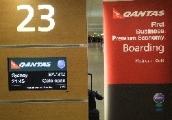 need to go to gate 23 and need to be there at the latest by 21:00. We walk through the airport and see Bar Bridge in the hall and drink a Hoegaarden and a Stella, in Great-Britain this is of course a pint Ė half a liter without foam Ė but weíre thirsty so thatís OK. We drink yet second one and have a small snack to share: penne carbonara. We eat it and then walk to gate 23 on time to start boarding. They begin with people from first and business class, then Premium Economy and then economy by five rows each time. First call is for rows 70 to 75, so it does not take long before we can board the aircraft. Eef has seat 56C and Timo 56B and in the seat next to us is Susan a lady from Sydney. Everything is going very well and we receive some info of what is going to happen: the first three hours of the flight we receive a comfort kit and our meal: Edamame Beans and Wild Rice Salad and then Poached Salmon with a Tomato an Garlic Sauce, Broccoli and New Potatoes. A bit later a snack and then day two has already kicked in, because weíve crossed the line to the second of November.
Day 2 and 3: Monday November 1 and Tuesday November 2, 2010: London Ė Bangkok Ė Sydney Ė Auckland
From London the flight takes us after three hours over Germany and then time changes to the first of November. It will be tough to get all in rang e with the times and dates, because we fly with the time. We currently have no idea what the local time of our position is, because we skip from one time zone to another. All goes fast to Bangkok. We fly to the east and must have passed a lot of Europe, but I did not notice that, because quickly after dinner and a snack, they turned out the lights and everyone in the plane went to sleep. Eventually both of us slept about four to five hours. Then we pass cities like Teheran and so we move on to India and also fly over Mount Everest. One hour before we make a stopover in Thailand, we get breakfast and we have the choice between hot and cold. Timo takes hot breakfast and Eef the cold one Ė yeah, in the hot one were eggs, we knew that.
We land in Bangkok on November first after a flight of eleven hours local time 16:00. This day has passed really quickly, because weíve been only sitting in the plane and have lost a big part of the day, only because of the time difference; that is really something special to experience. In Bangkok we need to disembark, then pass customs and then return to the plane for yet another flight, now 8 hours to Sydney. It is unbelievable, but for transit passengers they have a smoking area. Actually quite funny, you enter a room where you canít see anyone and still you add some more smoke, even if you could just breathe the air inside. A Thai guy of the airport personnel is seated and waves against the smoke, but nevertheless lights a new cigarette. We donít spend a lot of time in Bangkok and board at about 17:00 at gate G3. It is just the same aircraft with the same seats; only the people who stayed in Bangkok have given their seats to the people who fly from Thailand to Sydney, Australia.
For now all goes well and on time, the Boeing 747 leaves in time to Sydney and the first thing we get on board is dinner, at the start of flight QF2 from London to Bangkok we first got supper and before the landing breakfast, now we get dinner (chicken casserole and stir fried lamb) and then again itís breakfast, letís hope that will be all right. Of course this is going to be all right, never worry. Now we fly to the southeast, again to a different time zone. Over Malaysia, Indonesia we reach Australia via the north in Cairns. So we continue south until we land in Sydney.
This flight was not so long, but it was more difficult to sleep than the other flight. Now we slept maximum 1, maybe 2 hours, but plans are to do everything slowly the first day, so that wonít be an issue. At 06:00 we land in Sydney and we stay here a while till our fourth and last part of the trip will take us to New Zealand to the North Island in Auckland. That flight only leaves at 09:15, so we need to wait for about three hours. By the time weíve passed customs and found a place to write the travel reports on the laptop, it will almost be time to board. Timo writes the report to add this to his site and Eef strolls through the airport building, because we had to stay seated for a long time alr eady. At a few minutes before nine we start looking for our gate: number 27. That is not far away, itís just two stories down. Plenty of people are already waiting here, but our seats were already confirmed in Zaventem and we already have our boarding passes.
We donít look forward to this last flight that one is a bit too much now, but weíre almost there, so we need to hang in there. A small bus takes us to the airplane that is waiting for us a few minutes down the road and we can board immediately. With a delay of twenty minutes we can leave from Sydney to Auckland, our last trip for getting to New Zealand: with the airplane at least, because later today we still have another trip with a transfer bus of Apollo (rental company) and then still with the camper itself. We now have plenty of space, because the seat next to us is free. Timo takes the window seat and wants to check how everything looks. He does not see a lot, because itís raining in Sydney: the landing here was already bumpy. Now the sky is bright, so we see something: way far in the distance Timo spots the famous Opera House of Sydney or is this imagination.
A flight of three hours is not that much, so that will be OK. Timo watches a bit TV (2 episodes of Top gear) and Eef plays some games, because she canít sleep. The plane moves fast, although I think it might have gone faster. We land in Auckland on time and need to clear customs. There is really a long queue and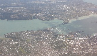 the Americans mentions words like primitive and a small airport, as if they have an ancient culture and they are less primitive, without making a generalization. It actually does take long, certainly if youíre already on the way for that long. But everything is OK, we get the first stamp in our new passport and then need to pass another scan with all luggage and bags.
This also takes a long time and that is especially about bringing bugs into the country, like for example surfboards and golf clubs, but we donít carry these and also no food. Either we ate everything on the plane or we left it there. Then we quickly go outside and have a smoke, because that also was a while ago: from the stopover in Bangkok: Thailand rules. Timo also searches for info on Apollo, because they did not pickup their phone or he has the wrong number. Via the I-site of the airport Apollo is called and we get the info where they will pick us up: a silver-grey van with ĎApolloí in orange and green is just arriving when he gets out. A couple with two children is also in the van. After the arrival at Apollo we ensure all paperwork is done and we inspect the camper. That looks good and new and all is fine. Eef thinks itís a lot bigger than she would have expected: 7.1 meters is a lot.
Checks are done quickly and then we can move on. We stop a few hundred meters down the road to withdraw money and quickly buy some basic stuff: beer, cola, bread, water and cheese. Thatís all a man needs to survive the first couple of days. And then the first big test with the camper starts: drive on the left hand side through Auckland during rush hour and now to direction of Orewa. First we mess up a bit in the suburbs of Auckland via Highway (HW) 20, but then we find our way to Whangarei and Orewa. At about seven we arrive at our first camping of Top 10 Holiday parks and there we spend our first night.
T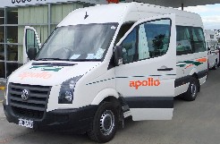 he way to the camping has already great views, but for now we donít focus on that yet: we just want to get to the first place, take a shower and go to bed. We already saw the two famous towers of the skyline of Auckland; we saw beautiful nature on the way here and also the busy traffic in the city. Weíre already completely enjoying ourselves and when we arrive at the first camping site, there is a shiver down our spines: stress is gone and weíre going to have a great time here. We can go to lane F, place 23 and then make a short walk on the beach and on the camping site itself. Then itís time to unpack, quickly send an e-mail home, so they arenít concerned and to make other people jealous. And then there is a great moment: after three days in cold airco-airports, on hot planes, next to stinking people we can have a shower. That is great, unbelievable. Brush our teeth and shave: that is also great. Shave was only for Timo, cause just to make sure: Eef has not yet grown a beard.
Especially brush our teeth is a marvelous feeling: we did receive small packages on the airplane during the flights, but that was not really that good. A person really needs that to feel clean. Then we eat and drink something, but a bit later (after the shower at 21:00) it really is time to go to bed. Tomorrow the real adventure starts Ė as if the flights were not an adventure. A few minutes after ten weíre already asleep.
Day 4: Wednesday November 3, 2010: From Orewa to Kaihu and Kauri forest
Timo is already awake at 06:00. He woke up during the night at about two to have a toilet break, but luckily he fell asleep again. Eef has slept t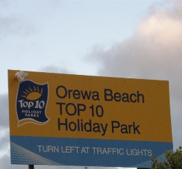 he whole night and has loved the sleep. It did us very well. Our first task this morning is a small walk on the beach to see the flying birds of New Zealand at dawn. Sparrows, gulls, pigeons: nothing really special this morning. Then we make coffee with the welcome package of Apollo and do our wash-up this morning. Then we make another walk on the beach and enjoy the rising sun. The sun is already rising before six and is now right in front of us above the sea.
This camping has a great location, but we assume that most of the camping of Top 10 NZ will be like that. Weíll know for sure within a few weeks. Here in Orewa there is a long sandy beach right in front of the camping and offers a splendid view on Motutapu Island. On the right side of the camping there is the mouth of a river and that causes a swirling amount of water along the shoreline. The sun shines and the weather is nice with only from time to time a cloud, but temperature is pleasant. A few special things to mention on the beach: starfish are on the sand and try to reach the water and you can see the tracks really well, a Eurasian oystercatcher lives here and also a species with black feathers and a red bill, sponges lie on the beach too and plenty of seashells, which is not out of the ordinary.
We mainly enjoy the sun and the view and at about eight we go to pay. We also fill out member form of Top 10 Holiday Parks. That costs 40 NZD and at every camping you get a discount of 10 percent. Thatís a good tip for anyone who travels through New Zealand. Payments have been done and we can leave. The planning today is a short trip to Dargaville. Timo did not want to do too much during the first days, so the distance is only 144 kilometers. The first part takes us via Waiwera to Wellsford. In Waiwera we stop, because the view from the road is marvelous. Eef already had installed Tourism Radio, which we received from Apollo and that gave the suggestion to stop here. Itís a place at the mouth of the river of the same name and means ĎHot Watersí. There is a thermal Spa Resort, but we limit ourselves to the view of the coast and a small islet in the distance. This is just great. After a stop of fifteen minutes we drive further to Warkworth.
Then on to Waiwhui Dome Valley and there we make a short walk. We park at a cafť and there a track starts to a platform with a great view. We walk on a small path of stairs most of the time and reach the viewing platform after less than twenty minutes. The indication was that the rack was forty minutes, but we do it faster. We see a lot of 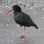 birds flying away: a black one with two white feathers on the throat and a brown and yellow-red bird and we see this very often Ė the last one looks something like a starling. The walk back uses the same path, but we donít get bored.
The huge ferns are really pretty and there is a very big diversity of plants and trees. Below most of the trees there is an indication of the name, but that does not means anything to us: kohekohe and rimu. The biggest impression for us are the ferns that are a few meters high and form a parasol at the top.
Via the city of Wellsford on the Hibiscus Highway we drive to Dargaville and check if we want to visit the kauri-museum. That is mentioned in none of the four tourist guides we have with us, so we donít do that: the entrance fee is also 17 NZD per person, so thatĎs also quite a lot. Weíve been driving through hills the whole time, but the road to Dargaville is flat and we follow the Wairoa River the whole time, so itís normal it does not go up and down constantly. In Dargaville we check our options, because there is supposed to be a Top 10 Park here. After checking we find out that is in Kaihu, about 30 kilometers further north. We drive there calmly and find it relatively quick. Itís a beautiful camping site next to a small river and we have the first choice for a spot, because nobody has arrived yet. The choice is gain 23, the same as yesterday and offers a view to the river itself. The time is about 13:30 and we look for something to do the rest of the afternoon.
We ask for some input from the lady at the reception: a kiwi walk tonight maybe and a bit further down the road there is Trounson Kauri park: a short walk is still possible this afternoon. We go there with the camper and take the walk. First of all we need to clean and disinfect our shoes, because apparently the kauri trees have had problems with a disease that people brought in. We see dozens of these giants of the forest, overgrown with plants and moss. The trees can get very large and there are trees here with a circumference of ten meters. They grow very tall in the sky to over thirty meters and we can say these are giants. The track takes us over a small path and takes about half an hour, when youíre in good shape. It is not steep like this morning during that track, but you can use a bit of condition.
When we return we make a grocery list, because today we did not buy anything and yesterday was really basic. So tomorrow we need to find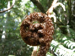 a big supermarket, because here in Kaihu there is nothing, except what the park itself offers. We need to find something there for tonight and tomorrow morning. Timo writes the report and Eef rests for a while. Later on we need to eat and maybe tonight weíll see our first kiwi in the wild. Here is one of the limited places in New Zealand where you can still find them in the wild. There are a lot of traffic signs with a warning for kiwis. Better to warn drivers that kiwis can cross the road.
As mentioned we were not really well prepared, because we did not have anything to eat for tonight. We buy something at the camping shop and try to make something up. Today we have white beans in a tomato-sauce and canned spaghetti. In the end it tastes good with a toast sandwich. After supper itís time for the ĎNight walkí. That is being organized by the owners of the camp park and we registered for it this afternoon, so we need to be at the office at 20:00 and then we go to the same reserve as this afternoon.
Now we donít have to drive for ourselves, but Herb takes us there: there are eleven people in the bus and we race in the dusk. Itís not completely dark yet when we reach the forest, so we first get a briefing about the dangers in the wood: carnivorous eels, raging mountain rivers. Not really the guy is trying to be funny. We knew that from this afternoon. We get a lamp and Herb tells us all about kauri-trees: they grow very large trunks and he explains how they grow. At first they grow in the shape of a cone, then they enlarge and then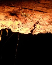 they start to loose the branches at the bottom. A good explanation of Herb. Then he talks about kiwis; the reason for our visit tonight. There are plenty of dangers for this flightless bird: cats, dogs, possums and even hedgehogs. After the explanation we go to the track, clean our shoes and then start.
Herb stops from time to time and tells stories of the life of the kauri forest. About weta (a large king of grasshopper, looks a lot like it) about species of owls, which we hear in the distance and more about kauri snails and night-fish and night-crayfish. We follow the same route as earlier today and it is nice to see it in a different light. Suddenly he makes us stop, because he heard a call of a male kiwi that calls loudly about five times. Itís too far away, so we move on to an old rotten tree-trunk where some glowworms hide. In a small piece of the river a long-finned ells finds it home, even two and a bit later everyone can see a small tree-weta and a very large cave-weta. The last one has very large antennae (20 centimeter) and long legs and tries to hide from us under a tree, but our guide Herb spots it, so we can take a good look at the insect. On another piece of tree there are four more large ones, but not as large as the first animal. A large black and white spider also hides in this tree. We hear another call of a female kiwi, but donít see it. She must be very close, because we even hear the claws in the leaves looking for worms and other food.
We follow a small creek the last part of the track of sometimes half a meter deep and see fish that only come out at night and then Herb makes us look for small crayfish in the water and guess who spots them? Timo spots a small crayfish next to a small branch and points it out to everyone. Yes, everyoneís happy and The Belgian rules: nice spotting young man. Herb is really eager to show us a kiwi, but heís not lucky today, not even on the grass where there usually is one. Bad luck it is. On our way back out of the park we see a possum, a real pest in New Zealand.
Then itís time to return to the camping with the bus, quickly smoke a last cigarette, drink a beer and then go to be, because we have been doing some driving and walking today.
Day 5: Thursday November 4, 2010: Kaihu to Paihia
A rainy day starts early, at seven oíclock weíre awake after a well-doing sleep and the rain has started to kick in today. Th at is not so good, but weíre in the camper, so we wonít get wet: keep on smiling. It stops raining a bit later and we can start our trip to Paihia of 131 kilometers, all the way to the east coast. We get ready quickly, have breakfast, but need to call Apollo first. After the trip yesterday to Trounson Kauri Forest the light of the break pads was lit. We need to check what needs to be done. A male Australian voice on the other side advises to drive to a town and then call back for more advice. Can we still go to Paihia Ė No problem answers the voice, but you certainly need to call there. So we follow our road as planned and drive to Paihia. First we stop to see Tane Mahute (Lord of the Forest). That is the tallest living kauri tree with a height of 51 meters, a circumference of 13,7 meters. The drive through the Waipoua Kauri Forest is nice, lots of curves, but really nice. The large ferns grow alongside of the road and we now see more kauri trees, because we now also recognize the younger version, as Herb explained us yesterday. We imagine weíre in a topical rain forest, like in Costa Rice, very nice.
We stop a few moments for a very pretty lookout-point close to Omapere, a scenic bay with on the other side a desert, which is a strange combination: the blue of the sea with the brown color of the sand and then the contrast with the widespread fresh Alpine pasture green of the hills. It is really a great lookout, the mountain chain is following us on the right side and we will cross them a bit further when theyíre not that high anymore. From there the HW 12 takes us to Opononi. There a tame dolphin has lived that they named Opo Ė regretfully he has died since then. The HW 12 leads us to Kohukohu where there are the Wairere Boulders, but we decide not to visit them now: we need to reac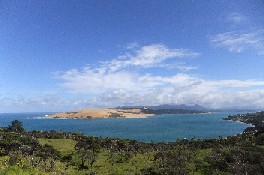 h Paihia as soon as possible to make the phone call. We drive the 60 kilometers in less than an hour: it takes some time, because we cross the mountains. We donít stop anymore until we reach Paihia and look for a parking spot for the camper.
The next task is to return the call of Apollo and Brian (also an Australian) helps us on, a lot further, because we then need to drive to Whangarei to have a check-up done of the brakes. Apollo scores their first bad points. The light has been on the whole time and he insists that we drive to Whangarei for a check-up. Eventually maybe correct, because brakes are important, certainly on mountains and hills. So we first buy some food in Paihia and then head for Whangarei. It should take according to Brian about two hours. The things we first buy are: water, bread, chocolate paste, marmalade, bacon, coffee, milk. After a light lunch we leave at about 12:45 and immediately need to wait in a traffic jam. Until now there were few or no roads where there were no works in progress, it seems the same as Belgium as the roads in New Zealand all look like construction sites (the part we saw until now at least). The trip from Paihia to Whangarei is very steep the first 10 kilometers, first up and then back down, but the road is good and in less than an hour we in the centre of the town.
Timo asks a pedestrian where Port Road is en he points us the right direction. We donít immediately find it, so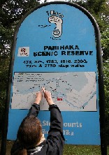 Timo enters a pub and ask the same question to two locals. A bit further we find Port Road just across a bridge. Now we need to find number 50. Weíre in an industrial park now with many garages and people who donít work officially it seems. Then we see the Volkswagen garage. Weíre happy theyíre already aware of our problems. They will assess what the actual issue is, so we walk to the port and drink something there. Timo gets a call from the shop and they say they have the parts, but they will only be able to fit them tomorrow. So we walk back to the shop and there we receive a lot of help from the lady at the desk and she says we can bring the car in very early and they will fix it. So we need to change our planning and we wonít reach Cape Reinga. The part far north will not be done this vacation.
We ask indications to where the Top 10 is here and can still use the camper as long as we donít drive to far. So weíre back on the road, cross the bridge, through town and to the camping site. We find it rather quickly and is also only ten minutes away, so thatís good, not too far. We will speak about this to Apollo, because this is actually an issue of not enough maintenance. If the camper already now has problems with the brakes, then there is something wrong. We certainly need to report this to Apollo, because this is something that canít be tolerated. So we changed the planning, weíll drive to Kataia tomorrow once the van is fixed and try to visit Ninety Mile Beach and the Wairere Boulders and also the glowworm caves on our way, weíll see about that. Yeah, we finally arrived: we drink a beer and enjoy the nice weather, because sun is shining and it is more than 20į. Although this will probably the only time weíll get to New Zealand, weíll need to live with the situation and hopefully this is the only hiccup weíll have.
W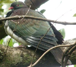 e try not to bother too much and do a walk to the Parihaka Scenic Reserve, after checking the planning again. We cross the camping grounds and walk down, arrive at a playground, but thatís not for now and then choose the track to the bridge over the river and then the track up the hill, first Drummond Track up to a lookout where you see the city. On our way up we encounter a lot of joggers and walkers and almost all of them say hello or do a small chat: New Zealand people are very friendly. We reach the top within half an hour. It is very steep with stairs, but also gravel track between the high trees and ferns. When we reach the lookout we have a view on the river, the city and the harbor. There nothing special to it, but itís a nice view and itís good to have some exercise. Weíve already had some beers, so we need to loose them now. Suddenly we stop for the national bird of New Zealand and take a picture: a pigeon, the New Zealand pigeon, which is a normal pigeon with some beautiful colors. We donít come back down via the same way, but walk via Dobbie Track to Hokianga Track all the way down to arrive back at the playground and the camping. We do the three tracks in twenty minutes less than the ninety that was indicated, so our condition is still good. And weíre glad about that.
Weíre pretty tired and we first take a shower, then eat and go to sleep. The showers on the camping are good, but the food is difficult to find today. We walk the route the lady at the office discussed with us, find the tavern, but the tavern has been changed to a normal bar and we donít want to sit and eat accompanied by several loud New Zealanders. Are we difficult? I donít think so. The takeaways are not open, except for one, but that one is really filthy, plus this is too far away from the camping, so the food would have bee cold by then. So we have bread with cheese, choco and marmalade with coffee and thatís good too. We chat a bit and laugh, complain about Apollo and the brake pads and then go to bed early. Again another exhausting day.
Day 6: Friday November 5, 2010: Whangarei to Kerikeri
We had to make an emergency stop in Whangarei to have the van fixed. At first we did not really like that, but eventually we had to live with it and we make the best of it. We have decided yesterday that we would drive north; especially to visit the glowworm caves in Kawakawa. But first we need to bring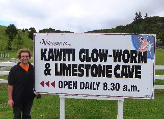 the car to the garage. We get up before seven, get dressed and drive back to Port Road in less than ten minutes. They will take care that everything is done at the latest by eleven and if earlier they will call. They still have Timoís number. Weíre early at the shop and they remember us from yesterday. We hand over the keys and take the most important things with us (bag pack, money, laptop and stuff) and walk to the centre. We even get an umbrella because it has started to rain by now. Not so good, but then again.
We walk past the different workshops to the centre, pass the coffee shop where we had a drink yesterday and walk to the centre. The bars and restaurants are still closed, but we already can have breakfast. Eef has a sandwich with marmalade, choco and honey and Timo, eggs, bacon and tomatoes. Eef drinks a bowl coffee with milk and Timo a small espresso. We enjoy breakfast and can follow the football match of PSV. Thatís strange, watch Champions League Football in the morning. Thatís a first. We look for an Internet Cafť, but donít find anything where they sent us. But thatís OK, because Timo receives a call. The lady from the shop calls to say that the camper is ready to leave, so we quickly head back to the shop and then we can go. We think a small token is nice for the people there and we buy a box of chocolates at a big supermarket.
We immediately get the van back and all is directly arranged with Apollo, thatís good for them and especially for us, because we would not have paid anything. Instead of being on the road at 11, we can already leave at 10. That is very good. So we head out of town and follow the signs to Cape Reinga, which we will not reach, but weíll need to come back for that. Direction Kawakawa to the Kawiti Glowworm Caves, thatís our first stop for the day. We find signs to the cave a few kilometers in front of the town and park the van up at the hill to the cave, because Timo did not want to take any chances of driving the steep hill down. He did not know for sure if he could drive it up with the camper, so he does not want to take any risks.
We walk the road between pastures and see a dozen of parakeets flying over the meadows and the trees. These birds are mainly yellow and green with a red part of the head and make a hell of a noise. For now itís impossible to take good pictures, so we need to try that at another time. We arrive at the office and ask how they arrange everything. We get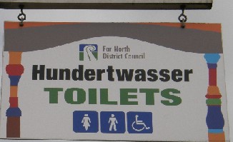 a guided tour of half an hour through the cave and then return to the parking on a bushwalk. We pay the 30 NZD and wait for five minutes until the young lady guides us through the cave. This cave is private property of her family and her grandmother or great grandmother has discovered it. She had lived for a couple of months inside the cave, because she did not approve that her husband had seven wives. Who can understand that?
The walk in the cave is over a bridge and takes us immediately to a small hall and the cave is not really impressive. There are some stalagmites and stalactites, but not impressive. She even says we can touch the walls; thatís something new too. She tells about the cave and then puts off her light. Along the walls of the cave and at the ceiling the glowworms hang down, but not really many. Once your eyes are used to the dark, then every minute you see more lights and after a few moments you can see thousands of lights in the ceiling. It looks like the galaxy and that is indeed the name of this hall. The guide takes us deeper into the cave and extinguishes her torch several times more and then again you can see thousands of small lights. She then explains that the light is being caused by a chemical reaction of the worm in its intestinal canal, so actually weíre looking at fluorescent shit. We laugh at the joke, but it still is quite impressive. In one of the smaller halls you can see the worms at a closer distance and that is even more beautiful.
Then we arrive at a broad piece of a relative small river that flows through the cave  and there lives a long-finned eel (Priscilla). This one is almost two meters long and there are about six animals like this in the cave. We like the walk and regularly watch with surprise and wonder to the ceiling. The guide tells us that in some seasons there is a huge flow of water coming through the cave and we still see branches and leaves on a flat rock about one meter above us. That means that this part has been previously flooded, even recently in September. Another hall of the cave is called the butcher shop, because if you have plenty of imagination you can see three turkeys, two sheep, a piglet and one big pig. But you really need a lot of imagination. After half an hour we see the light at the other side of the tunnel and then the guide leaves us: we need to follow the signs to the parking and that is the second part: the bushwalk.
When we see daylight again, our eyes need to adjust to the light again and then we walk five minutes up and then another five down to reach the parking, coming out of the forest. A short, but beautiful walk. We buy four postal cards of the cave, because inside we could not take any pictures and then we go back to the van. We find the campervan unspoilt; something Timo likes a lot. He was a bit worried, because it was only parked along the road, but all was OK and we drive further to Kawakawa. There we stop to visit public toilets. What? Que? Yes, indeed weíre going to visit the public toilets of Kawakawa, because they have been designed by Hundertwasser, a famous Austrian painter and architect. He has lived in the neighborhood or still lies there. Note: he died in February 2000.
We first pass the toilets, but eventually find them thanks to a helpful police officer. He warns us we should use the pedestrian crossing; he needs to sa feguard the tourists. And then weíre taking pictures of public toilets. A German guy speaks to Timo about that, because heís never done that before. Yeah, we know the feeling. I other circumstances we would certainly be followed by the vice squad. We quickly buy some groceries here and then drive to Kerikeri; this has then become the change to the planning and our stop for the day. Weíre not in favor to drive all the way to Kataia, so we stop here. We first look for a supermarket Woolworth and that took a lot of effort. After half an hour searching, we find the supermarket between other shops and enter. Food for today and tomorrow, beer, wine and other things. Then we drive the last small distance to the Holiday Park, just five minutes outside the centre and park the van on a still empty camping.
We take the tour to check out the terrain Eef goes out to surf the Internet and Timo writes the report of the day. He had a lot to talk about today. Later we enjoy the warmth of the sun with a cigarette and a beer. There is a hard wind and the sun comes through the clouds, but itís spring here and that is really good: a nice change when winter starts in Belgium. In the meantime a British and an Australian couple have arrived and they have a chat with us. We still have to eat too and while Timo takes a shower, Eef starts preparing a meal: chicken in red-wine-sauce and gravy and paste. Within half an hour this is ready and we can eat. The Top 10 Holiday Parks are well equipped and there is always a complete kitchen available for us. We drink a bottle of wine and enjoy the food and drinks. After that the dishes need to be done and then we go to bed. As usual on vacation it is not late, because at 22:15 weíre already in the camper.
Day 7: Saturday November 6, 2010: Kerikeri to Tutukaka Coast for diving
At six in the morning the sun is already rising and the sunlight wakes us. Timo goes for a morning walk to spot some birds. Instead of bir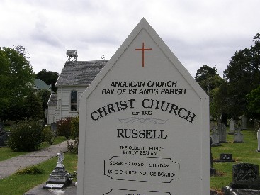 ds he sees a rainbow over the tropical New Zealand rainforest and he sees steam over the river down below and a duck with her offspring is silently waiting until something edible passes by. Sheíll find something for her and her chicks. After an hour he returns to the camping and Eef is already preparing breakfast. She has installed foldable table and has put everything ready for a good breakfast: bread, coffee, cheese, bacon, ketchup and cereals. Thatís a nice surprise: thanks Eef.
We have breakfast and many birds come to the bread and the cereals: ducks, sparrows, blackbirds, finches: many different species. The sun is already up and it starts to get warmer, so we sit in the sun and enjoy the weather getting better: this is starting to feel all right. Timo cleans the table and stores everything away. Eef takes a shower and Timo needs to check the level of oil of the van. He gets some help from the English neighbor: heís a trucker and he sees that everything is still OK. After breakfast and the shower we can leave, because we have quite some distance to cover today. The trip goes from Kerikeri to Tutukaka. We certainly need to get there on time to dive tomorrow: we canít miss that one.
For the first time Eef will drive and leaves directly from the camping site. From that spot it is immediately very steep uphill and she needs to use first gear to get up. Because the engine was still cold itís not easy, but Eef manages fine. She needs to get used to drive on the left side, but she does well, especially turning on roundabouts itís quite an adjustment. We head south to Kawakawa, but donít stop there today. Today there is not a single person in the village, opposite to the busy traffic yesterday. From there we take the HW 1 to Whangarei and Auckland, but leave the highway to drive 67 kilometers to Russell. That is a small coastal village, but should be a beautiful one. We have plenty of time, so we also want to spend some time there. The road takes us away from HW 1 to Russell. It takes longer than we would have hoped for, because at first we thought it was only 47 kilometers, then we saw a sign of 66, but in the end the distance is 76 Kís. There and back it takes us mor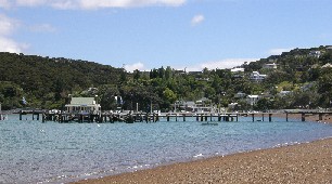 e than an hour extra.
We drive over hills, see sheep, goats, horses and cows in their paddock. The road winds up and down until we drive next to the sea and then it winds even more through the mountains. The ferns, the high trees and the lush vegetation are providing great views and take us to the hills along the coast. There are beautiful bays, about six of them. In several tourist-guides they call this the most beautiful road of the north, but thatís not really the case for us at this point. Itís nothing more or less than other roads we used during this vacation. Then we finally see the bays and they are indeed beautiful, but for the most beautiful road of the north I would have expected more. The last few kilometers to Russell form a chain of paved roads through mangrove forests and rivers and spring-green meadows where cattle is grazing.
After one hour and thirty minutes we arrive in Russell and see the oldest church of New Zealand. In front of the church there is a cemetery and it looks like most people die here younger than in Belgium. We see more graves of people of the age of 30 Ė 40 than of people older than 70. On the tombstones we donít see the date of birth in most cases, but only the date of death and the age at that moment: rest in peace.
We also want to see some more of Russell, so we walk a bit further and then enter the museum. This is mainly about Maori, the old English occupier and their whale hunting. Itís not really something we like, because we prefer to help and look after animals, and certainly donít want to kill them. We do have a look how Captain Cook and his crew were able to catch whales from their small boats with the help of the Maori. The museum has only two halls and is not really exhibiting a lot of a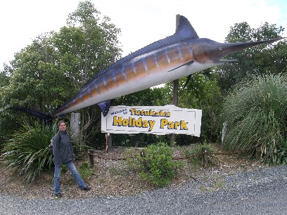 ny interest, but they do ask 15 NZD entry fee. On exhibit there is a replica of the boat of Cook, but other than that there is nothing much to see, other than some cutlery of the different English fleets. I donít know if many people want to see this, but we did: yes.
From Russell Timo drives the same way back to HW 1 and we see the same stuff as the way to Russell. Because Timo is driving now, he has the impression itís not that far as when we went there. In the end after in total three hours weíre back at HW 1 and now we finally can continue our way to the final destination of the day: Tutukaka. From HW 1 itís only 26 kilometers until we should arrive there and these last kilometers seem to be the longest of all. After half an hour we arrive at Tutukaka Harbor and there we look for the camping site. We do find the dive shop and enter there, and then we can make arrangements for tomorrow. Timo is the first on the planning, so weíre certain we can dive tomorrow. We fill out some forms and itís all done: time for a beer. We have a beer but on the camping site. The camping is only a five-minute-walk from the dive center and has been signposted with a marlin, itís strange we missed that one when we arrived, because we passed by the sign. We take the camper and drive there, report to the office and pay 90 NZD for three nights here. We have site 14 all the way at the end of the second row and drink a beer. We get some company from mother duck and her five chicks, theyíre really cute.
We ensure all is arranged and then we can take a look at the harbor. We see a gas station on our way to the harbor and a small shop, so we buy bread, beers (Lion Red Ė Beer from new Zealand) and take that back to the camper. The beers can stay cool for later. Then we take the same way back to the harbor and have a drink at the bar. We have a pint of lager (13 NZD) and enjoy the sun. When the sun shows between the clouds it is nice 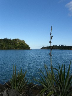 and warm, but in the shade and in the draught it can get chilly.
After the first drink in Tutukaka we walk to the harbor itself and then suddenly Timo spots a stingray IN the harbor, unbelievable really. It would be really amazing if someone could beat that sighting. Not really that is. We walk to the end and then return to the bar where we were earlier and have another beer (weather is thirsty) and also decide to eat something: beef roasted file with mashed potatoes and garlic courgettes and also hapuka (fish) with coriander sauce and green asparagus. The fish is fresh catch of the day and is also the suggestion today. We drink some wine with it: a bottle of syrah, Sailfish Cove and that goes perfectly with the meat and the fish. At about eight we ask for the bill (118 NZD, which is not that much) and walk back to the camping. Eef falls asleep immediately and Timo writes the daily report, because otherwise he would forget and it would get more difficult every day and we would see more each day too. Letís hope, because the dives are really something for us. At the dive shop Timo received a code to surf the Internet wireless, so we will use that tomorrow. Weíll what tomorrow brings; it wonít be bad, because dives in the Pacific are really great. Weíll see tomorrow.
Day 8: Sunday November 7, 2010: Dive the Poor Knights Islands
Three in the morning and Timo is awake by the mobile phone. Apparently Davy of Kaai24 has called. Heíll have to wait until I return. Since weíre awake we go to the toilet and briefly enjoy the marvelous nightly starry sky. At least you can see some starts here. If there are not a million stars visible, we see none. There is not a single light on, only one in the cabin a bit further. The sky really looks beautiful. Eef also checks this out and then we go back to bed. At about six Timo is up and starts to correct  the report of yesterday. There are many typing errors in it, because in the end he had enough to drink. He comes out of the camper and is being welcomed by the duck family and on the pasture behind the camping there are many rabbits. Itís about time to prepare for the dives, so we do that. We mustnít forget anything and arrive on time.
We walk to the dive center and the welcome is very good, it is a very professional center, because everything is running smoothly. They have two boats for today and on one there are ten people and the other one has twelve. Everybody has to try his/her gear and they put everything into bags and will load it to the boats. Weíre on ĎEl Tigreí today for The Poor Knights Islands. Thatís where we want to be today! Ben and Evan (Canadian and American) are the skippers and the dive instructors. Theyíll announce what will happen today. Before we board the vessel we encounter a lady from Vilvoorde and we start to chat with her and for the whole trip we have company.
We leave on El Tigre to the Poor Knights Islands at about nine and it should take us one hour and fifteen minutes to reach the islands. We canít see the islands from the harbor, but once weíre on open sea we see about three large islands in the distance and we go to that direction today. The sea is pretty choppy and Kristien (the Flemish lady) has taken some medication against motion sickness, just to be on the safe side. But everybody is OK, no stomach have turned during the trip. The two skippers take turn to drive, because it would get boring for them. Our first diving spot is Middle Arch. From the boat it looks very nice. Itís a large arch in a small bay with high rocks at all sides.
Ben gives a short briefing with some additional info on the islands itself. In the past there were many different species of birds, insects and reptiles, but also introduced species. They were all wiped out, so the native fauna and flora could regenerate their numbers. We see gannets and some shearwaters: this species of shearwater is endemic to these islands and does not even live on mainland of New Zealand. The briefing is about the dive site itself and thatís quite easy: follow the wall with the right shoulder and then we should see the arch and then a cave and then turn back. Timo thinks he should be all right. This means that we will only dive the two of us, no probs.
We prepare everything, put on the double 7 mm and then after a buddy check we can start the dive. Weíre the last buddy team in, but weíve got plenty of time, because weíre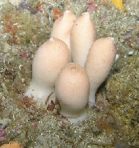 on vacation, so no worries. Thatís something they use here all the time and Timo already started to us it too. So no worries! We swim on the surface to the wall to ensure we donít have to go too deep at once. Timo leads the dive and follows the wall at his right side. We slowly go down and reach a maximum depth of 20 meters. Then we follow the wall and we already spotted many small fish, but also kelp. That is something special, something weíve not seen before during a dive. The sight is special and the plants are attached to the rocks with a small foot. The rocks are not grey, but more red and orange, really pretty. During the first fifteen minutes of the dive we donít spot that many species, mainly wrasse and damselfish. After that our eyes are used to the special colors and the circumstances we see a large scorpionfish. And when I say large, I also means large. We estimate the size of the fish to forty centimeter, this is amazing.
We reach the arch without problems and dive inside. They warned there could be some current here, but that would be mild, canít really be described as current actually. And then Timo sees the first nudibranch, and then another one and another one. Once weíve seen the first one we see more and also different species, not always the same but in total four different ones. The one is mainly white with orange dots and dark red feelers, the other one looks exactly like a rock and the third one is a combination of number 2 and 4 and the last one is really beautiful. The main color is green and blue and a bit black, really thť species of New Zealand. We see some blennies in different places and also different kinds. A specific feature is that the eyes of the triplefin are beautifully blue.
We see everywhere the jellyfish and the scorpionfish and the kelp. Between the kelp-plats there is also a yellow moray, also very beautiful. We see some of the other buddy teams and it also seems like theyíre having fun. We turn back via the same route and after 56 minutes we also return to the surface. That was enough and it gets colder, even with a double 7. The temperature at the bottom is only 15į, which is pre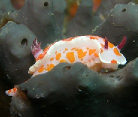 tty cold and they especially asked upfront if we were used to dive in cold waters. I would say yes. So the first dive is over and it has been really a great experience. We take a surface interval to get warmed up and then go for the second; hopefully that one is as good as the first. We have our lunch that we brought from home (the camper that is, because it is our home for a week already). Bread with cheese, choco and marmalade. We get coffee and other hot drinks on the boat for free and we can really use that right now. The second hot drink is soup, not fresh one, but out of sacks. It does well, especially for Eef, because she was shaking all the time.
After lunch the two skippers take us to the biggest sea cave in the world. At least that is what they say, because nobody seems to know the exact dimensions of the cave. The acoustics are really good and we all need to demonstrate that by yelling very loudly. Then we drive ten more minutes to the second dive spot. The first was Middle Arch, the second is Jans Tunnel. First we need to get back into the wet wetsuits, which is not pleasant, but then sun is there and has warmed everything up a bit. We use the same plan for the dive, but now the other way around, dive to the right. Everything OK and now weíre the second buddy team in the water. We see the same fish, the same kelp and also two nudibranches. During this dive we spot less things than during the first one, but it s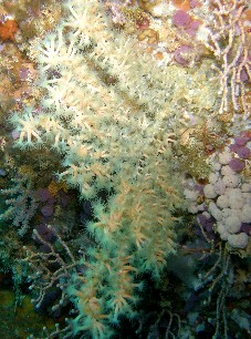 till is quite nice. Then suddenly we see a large white tube coming from a rock, it is about four meters long and 40 centimeter wide. Later they tell us this is a colony of animals that have assembled into one shape. Itís very special and looks funny. We dive through the kelp forest and again see many scorpionfish, one moray and beautiful anemones on the rocks.
Suddenly a yell goes through the water. Timo has seen the most beautiful anemone. Till recently weíve not spotted this species, but in 2010 once in The Netherlands and now once in New Zealand, small difference. We dive through the caves and swim troughs and see plenty of beautiful things, also coral thatís hanging from the wall over the depth. Everything has beautiful colors here, from brown over orange, blue, green, red, purple: we see all colors of the rainbow. Itís much colder than the first dive and now we stop after 46 minutes. We end up very close to the boat, so Timo has really learnt from his specialty course navigation. He really paid attention to a big crack in the side of the wall opposite to the boat and new he had to swim away from the wall there. Back on board take all the gear and put everything away, then dry up and then there is still an hour back on the boat to Tutukaka. After a beautiful day of diving we drink something at SchnappaRock, the restaurant and bar next to the dive shop. Then we return to the camping: Eef tot take a shower, Timo to write the report and to load all the pictures to the laptop.
Then we still have time to return to the bar, because we can use the wireless for free. After many problems Timo manages to connect to the wireless. We send a few mails with some picture to Linda, Patrik, Jurgen, Roel, Maurits, Leentje, Aagje, Veerle (the most loyal website-fan) and let them know everything is OK. We have two beers and then return for the last time back to the camping. While Timo takes a shower, Eef prepares a meal: spaghetti with tomato-sauce. Itís a bit spicy, but really good. After that itís time to go to sleep. Eef is down at 21:30 and Timo finishes the report and after ten sleeps too. A very exhausting day comes to an end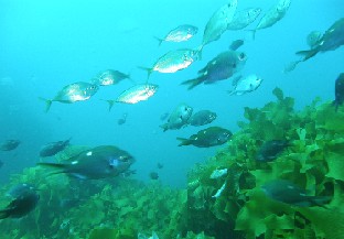 . Tomorrow we dive two more times here and then we head further south.
Day 9: Monday November 8, 2010: Dive the Poor Knights Islands
Today is our second dive day on The Poor Knights. We get up at 06:30 and have a small breakfast and drink some coffee. We prepare again everything to go diving: computers, cameras, under water housing and masks and snorkels. We have time enough today, because we left the diving equipment inside the bags and we only need to be at the dive center at 08:30. Thatís much easier. A few minutes after eight we leave to Tutukaka Harbor and there it looks like a beehive again. A bit less than yesterday, because today there is only one boat: Calypso. We wait for the boat and we should leave at about 08:30. They are very punctual here and that is very nice.
A few minutes late the boat leaves the harbor. This one is even bigger than the one from yesterday, we think that there are 15 divers here and then a few snorkelers in addition, but more about that later. Off we go and the sea is much calmer than yesterday, which on itself is nice. Firstly for the ride there and secondly because we might spot a whale now. Going there we donít succeed. Timo looks for a spout from the upper deck, but sees nothing that looks like a whale. Bad luck, but we mainly came here to dive. Everything is better, because now we arrive there within an hour. Timo had been chatting with a lady (Ann) from Hawaii and was talking about diving and snorkeling. She even says she heard this was the most beautiful spot to dive in the whole world. The dives of yesterday were good, but to say the best: thatís something else.
We receive the briefing together with another buddy team first. Weíre at a dive site with four rocks. We need to find the first rock on the surface and then dive to the other on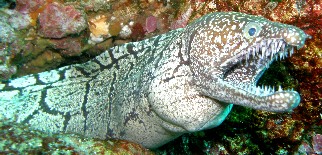 es. We quickly find the first one at about twenty meters from the boat. Here we start or dive and we see the environment is the same as yesterday. The kelp plants rock with the current and then rocks are covered with colorful plants and anemones. Very beautiful. We dive around the rock and when we reach the other side, we need to dive 5 meters away from the rock and then need to see the next one. We stop on the way for a hug scorpionfish and a few nudibranches. They are really big and measure 8 to 10 centimeter. And in addition they have beautiful colors. One of them has a kind of veil with brown, green and blue parts in it. Because theyíre so big you can clearly see the antennae and the feathers that are on the antennae. The animals are really magnificent.
We see a mosaic moray and it looks very dangerous with its big teeth. Its body lies on the rocks and is dark brown with lighter spots, a magnificent animal. Right next to it we see a scorpionfish and they are also amazing (canít call them pretty) and they almost donít move. They are so convinced you canít see them that you can get very close to them, but we donít come too close. We turn around the next rock and see more nudibranches, a white with orange spots. The feelers are purple-red and also the plumes at the back of the body. The number of fish is larges, but the variety of species is not that big and the water here is still too cold to see the real tropical species. After half an hour - the camera-batteries are dead Ė we turn back and there we enjoy in shallow waters the beautiful views under water.
After 56 minutes weíre finished, because it starts to get cold. We climb on board, receive a hot drink and set ourselves to dry in the sun. Eef is shaking the first twenty minutes, but in de sun this is over soon. Timo is used to the cold water and it does not bother him. Yesterday he was cold during the second di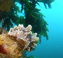 ve, but today all is well.
Everybody is back n board within half an hour. Everybody? No, not really, apparently they are missing a snorkeler. Nobody is worried, until Luke (instructor) has searched the whole bay with a zodiac and has not found the girl. He even searches outside the bay and finds nobody. Even the large boat takes part in the search and another boat from another dive center is checking too. The search lasts for about an hour and then they go to a different bay and then on to the canal between the two main islands: nobody can swim that far? Apparently someone did, because way south of the most northern island Luke finally recovers Bianca. What do you think youíre doing? Swimming back to the boat. Youíre swimming away from the boat. In the end everyone is happy sheís found and we can go to the second dive site.
This time we get the briefing from another instructor, Sam and that briefing is really very thorough. We dive through a tunnel, then keep a left, maximum depth 1ŗ to 12 meters and then follow the wall ad then back to the boat. In theory you should be able to do this within ten minutes, but they advice to dive very calm and then you can reach a long dive time, since maximum depth is only 15 meters. We enter the water first, 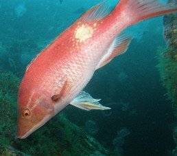 because in the tunnel/cave you can see millions of blue mao mao. We go down, dive into the tunnel under a big boulder that keeps the light out, but once through that we reach a huge hall where the light comes from everywhere. There is a beautiful play of light coming down from the holes in the cave and then the blue color of the mao mao: a simple fish, but itís great because the numbers are so huge.
When we come to the end of the tunnel there are a few boulders and rocks and we follow the wall at our left side. The jellyfish are always present; they flow in and out and over and under everything here. They donít move a lot, but they are present in that huge numbers that is gets annoying sometimes. When you try to take a picture of a fish or of your buddy, theyíre always in the way. Can get annoying. We see a mosaic moray again and a few large scorpionfish and a couple of big pigfish. They are red and beautifully contrast with the dark background inside the tunnel, because we donít see them outside. Also the nudibranches are here again. The blue-green one with a plume and also the white one with the orange stripes. Timo has plenty of fun taking pictures. We followed the briefing very well, so we arrive at the boat. The dive was really easy. We see the anchor line and stay close, but after forty-five minutes weíre getting too cold. At our maximum depth itís only 15į and that is comparable to the last dives back home.
We end our forth and last dive with beautiful memories and nice pictures, so this mission is accomplished. We take everything off and then get warm with coffee and tea. A cigarette in the sun on the smoke deck is nice. After about fifteen minutes Eef stops shivering and then the rest of the different buddy-teams return also. Nobody is missing now like earlier today. Then the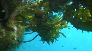 girl had been swimming for over two miles; that is really far. We prepare for our journey back and hope to see whales, but weíre not lucky today. In Kaikoura we might see whales, who knows. The return goes well and in less than an hour we back at the harbor. A couple of gannets join us on our way back and then we can go back on land. We drink a beer, eat some fries with mayo, ketchup and onion and then go back to the camping for a shower. Eef cleans the camper and Timo takes a shower and then itís her turn. One hour later we return to SchnappaRock and the dive center and have a drink and use the wireless Internet.
We freely use the Internet and the best one is SchnappaRock; Timo canít connect to the wireless of the dive shop. We check out the pictures of the dives and are very happy with the nudibranches, morays, fish, tunnels and caves. Most of them are pretty good. We see that some triplefins are beautiful and we recognize about three different species. After a beer at about eight we go back to the camping and have another beer, some chips and Timo finishes the report and at about nine weíre tired enough to go to sleep. The days we dive are always tiring, so also today and weíll need our rest, because tomorrow is another day, when we need to cover a lot of kilometers. We also need to stop for some sightseeing, but weíll see where we can go tomorrow. Sleep tight!
 Day 10: Tuesday November 9, 2010: Trip to Rotorua
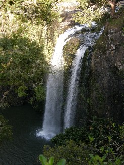
We get up at the same time as the chickens, better with the ducks. Mother duck and her six, not five, chicks are waiting right in front of the sliding door of the camper until we feed them. They eat cornflakes out of our hands. Thatís cute. We do our morning stuff only half, just coffee, because we have a long drive ahead of us. At a few minutes past seven we first stop at Dive! Tutukaka to buy two T-shirts and then we can start the drive of well over 500 kilometers. How will that be? Weíll see. First we drive to the village of Ngunguru that has a magnificent location and then on via a small road to Whangarei. A few kilometers before we reach town we stop at Whangarei Falls: 17 meters high and really beautiful, close to the main road, so we donít make a big detour.
Then we need to cross the center, have a quick breakfast and withdraw money and then take the HW 1 to Auckland. It strikes us again that there are road works everywhere and that slows us down, but weíll manage like this: weíll arrive later at Rotorua, but weíll get there. We follow the sign to Auckland all the time and then need to cross the North Island from east to west, because we want to stop at the Gannet Colony of Helensville. That is about 150 kilometers and we find our way very well. Off Wellsford we follow HW 16 and reach Helensville without a problem. There we take the coastal road (11 k) to Muriwai Beach because thatís where the gannets are. We park the camper and already hear the sound of the birds when we get out.
A small path takes us to the cliffs and there we see a small island in the distance, a little rock right in front of us and also the two heads of the rocks are covered with white dots. The place is filled with gannets. We can even smell them from the viewing platform, which is not pleasant, but the view is fantastic. The black and white birds with their yellow head and their dark beaks are really the most beautiful animals. They come and go and the females are on their nests and the males bring food for them. Others are seducing each other; they donít have any ages yet, but keep themselves busy. It is really marvelous to see how these birds glide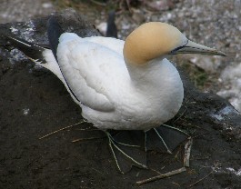 through the sky and then suddenly fall into the water like a bomb to hunt fish or other edible things. We stay here about ten minutes and enjoy the spectacle. On the rocks there are also other birds, but I canít remember the name right now. Theyíre terns. A local explains to Timo that in the past the birds were only occupying the island in the distance, then they came close to shore to the rock and since a few years theyíre also using the cliffs. Thatís a good sign, because every year, he says, more and more arrive. The other bird species have also recently arrived and also that is nice. This explanation is also on the stone table at the top of the cliffs, so it must be correct then.
We take the camper and drive back and then to Auckland. There it is a bit more difficult, because we take a wrong turn for 20 kilometers and also 20 minutes. We were already on our way back north and that was not the intention. We turn back and find the correct sign to Auckland at road works; itís there where we missed the turn. These works are of no benefit at all. The highways around Auckland are very busy, even at this time at noon, but we find our way to HW 1 and now without a detour. Then we go to Hamilton, but we get off the highway at Bombay and then via HW 2 and 27 drive to Matamata. There is Hobbiton and that is so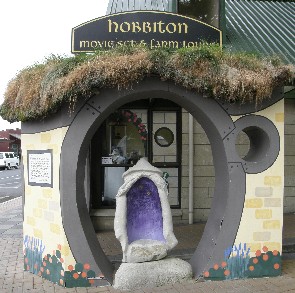 mething we need to see the one time weíre here in New Zealand. We have one stop for a cola-cigarette-beer-break and then drive the last 80 kilometers to Matamata. This route is amazing. We drive through a flat landscape with on our right side the Kaimaia Mountain Range and we love cruising down the landscape. It progresses very fast and itís nice to drive in such a landscape. We donít stop however, because first we need to stop in Matamata and then reach Rotorua.
The first stop in town is the I-site and they tell us you can only do a guided tour to Hobbiton. So we need to buy a ticket, which is expensive (66 NZD), take some stuff from the camper and then immediately go on the bus, called Gandalf, because the tour leaves in five minutes. A lady with curly hair, resembles a hobbit a bit with her comical appearance and her funny smile, takes us to the farm of the Alexander family. The movie set is on their property and we see the houses of Sam and Rosie, of the grumpy hobbit from the start of the trilogy, the party tree and the road where Gandalf and Frodo meet. They are working here to record the next movie, The Hobbit, so more we canít tell, because weíve had to sign a copyright contract. Everything we hear and see on the tour canít be told or published on the Internet or anywhere else, otherwise we can be sued. The tour takes about two hours and then we get a demonstration of sheep sheering and some people can bottle feed a few lambs. Theyíre really cute. The lady takes us back to Matamata and then we start our last trip of the day to Rotorua.
This will be about 70 more kilometers and in less than an hour weíre there. We drive to the center and find the Top 1ŗ there and can take the last powered site today. We quickly have a drink and then go out to explore the city. You can smell volcanic activity everywhere: rotten eggs that is. In one of the streets we see The Belgian Bar and weíll sto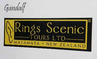 p there for a drink later on. But first we walk to Lake Rotorua and look for a restaurant, but donít find much. In New Zealand it seems they donít have the go-and-eat-culture like we have, but rather take-aways, so we first have something to drink at the Belgian bar: the bartender and owner if a Dutch man from Brabant, so he has a connection to Belgium rather than The Netherlands. We also see the couple with whom we were diving; a German couple also from the dives and on the camping there were again the English and Australian couple from Kerikeri-Top 10. Rotorua is a place where people meet.
We drink a Duvel of 11 NZD and then have a snack at Nandooís: chicken burger and chicken wrap and then return to the bar, where we again meet the Dutch couple (they live in Singapore) and itís pretty later when weíre back at the camping and itís already late when we walk back to the camping with them. Timo feels he had 4 Duvels. After ten minutes weíre there and then we immediately go to bed. Timo will write the reports tomorrow. Weíre really happy weíve been able to do so much today and still drive such a distance. Tomorrow weíll explore Rotorua and then drive on to Whakatane, where we reserved a tour to White Island. That should be worth a visit.
 Day 11: Wednesday November 11, 2010: Kiwi Encounter, Maori, volcanic activity and Ohope Beach
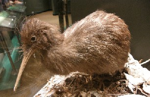
After a good night we get up at seven. That is late, the longest weíve slept until now. We have a few things to do here in Rotorua, so we donít take too long and immediately leave the camping and go for our first experience. Timo drives to Kiwi Encounter, where we get information about kiwis and how theyíre trying to get the population of the birds in good shape. We find Kiwi Encounter at Rainbow Springs and the Caterpillar Experience. We pass by, because Timo still works for Cat, but it seems more like an attraction for kids, so we donít think itís for us. Weíre lucky just like yesterday in Matamata, because the guided tour of the Kiwi Encounter starts in five minutes, at 10:00 Jody is our guide and she brings us with nine people behind the scenes. We get some general information about kiwis and we already knew that from the tour at Trounson Kauri Forest. Nothing new for us, but maybe for the others, so we listen and are good.
We enter the dark rooms of the Kiwi Encounter and then can hold a real kiwi egg. They changed it to the actual weight as is would be and itís very heavy, especially if you know that a kiwi is only the size of a chicken and the egg is almost as big as an ostrich egg Ė almost that is. For such a small bird it is very heavy. We get some background info o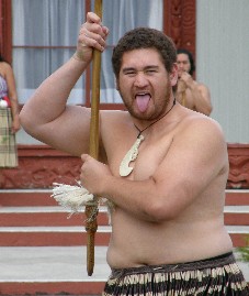 f what people do here. They take the eggs from the males, because theyíre on the nest and not the females. The birds need to sit on the eggs a very long time and sometimes need to leave the nest. And just when the eggs reach the age of 40-60 days, they are being removed from the national parks. They know of one male from who theyíve take already 50 eggs. Thatís mind-blowing and for the female too, because she has to lay the eggs in the end.
After theyíve taken the eggs they are kept in an incubator and there they get turned over a couple of times a day, because the males would also do that in the wild. They keep a close eye to the eggs. Then after a few weeks the eggs hatch and then go to the nursery. There the chicks, really cute by the way, are fed manually and the centre has developed special food for them. We see two ladies feeding two small kiwis. One is a few weeks old and the other one only a few days. That also means that is works better with one than the other. The last part of the tour is the nocturnal house and there are three adult kiwis, which are scratching through the bushes. Once the chicks are 1 kilogram, so at the age of 21 days, they are set free to the wild. Thatís the nice bit, because they now have a survival rate of seventy percent, as opposed to the wild where they only have a survival rate of five to ten percent.
After the Kiwi encounter we can have a walk through Rainbow Springs. There is a lot to see there. We start at the end and walk the tour in opposite direction. Our first stop is a big pond with rainbow trout. There are in total four ponds here with all different phases of the trout. The biggest ones are here in the lowest one and the smallest on top. The animals from the farm is not our thing, so we pass it, but we do see some endemic animals of New Zealand: tuatara, a reptile, gecko, skink, only the last ones we donít see. The three most important things we see here are: kaka, kea and the long-finned eel, which we also saw at the Trounson Kauri Forest during our night walk.
After the Kiwi Encounter and Rainbow Springs we look for two other things to do in Rotorua: something with Maori and with volcanoes. We look around and find Te Puia that combines both experiences. On Hemo Road we see the main entrance of the park. They say weíre just in time for the show of 12:15, so again our timing is perfect. We immediately go to point four on the map and it says there ĎMeeting Point for Concertí. A lady dressed in typical Maori clothes sees us and explains what will happen. When the five warriors will come out of the Rotowhio Marae someone from our group will need to go to them, when they have put a fern leaf on the gr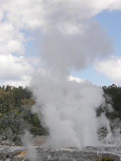 ound. That is the invitation that weíre welcome in their place. They come out with a lot of noise and Ron (from our group) approaches them and does what is expected from him. Half way down the field one of them has put down a leaf and Ron needs to pick it up and take it with him. Then they make again hell of noise and thatís the sign that everyone is welcome at the Maori pa. Wikipedia: The word pā can refer to any Māori village or settlement, but in traditional use it referred to hillforts fortified with palisades and defensive terraces and also to fortified villages.
Then we actually can enter the ĎCultural Experienceí. The guys also had Ďtheir wivesí with them and they start singing. Inside the pa they sing and dance in total half an hour and then how the Maori have used their weapons in the past. It is informative, but also a bit of a tourist trap, but hell yeah. If youíve been to Rotorua and havenít seen any Maori, then youíve never been there. Itís entertaining with a lot of dancing and tricks and a lot of singing. The house is half full of tourists and these men and women do this about three times per day. After the performance we do a short tour in the museum and then to Pikirangi Village. Here theyíve tried to mimic the Maori-stile with a few pieces and they also show how they lived. The question is whether they still do it today.
Then we still need to see the rest of Te Puia: Te Whakarewarewatanga e te ope taua a W„hiao or: The Gathering Place of the war parties of W„hiao. This part of the town is located in a geothermal park with the climax of the geyser Pohutu that erupts two or three times per day and spits hot water. We walk down the path, stop first to see the kiwi-house and see two adult kiwis and then on past hot and swirling mud pools to reach the geyser. It just started to erupt and it is a very beautiful sight to see what the earth is capable of. When we get to the geyser itself, it still is erupting and spits water on us. All this sulfur canít be good for people, can it? From a higher point we can see the blue pool. The water is bright blue because of the chemicals in the water and the soil. The water runs damping down the rocks and everywhere you look, you can see smoke of a small crater of a large pool of out of the geyser.
We see some more mud pools and thermal springs en then return to the main building to pass by the gift shop to the parking lot. Also the part of passing the gift shop is a tradition in New Zealand. We quickly think about whatís next and then 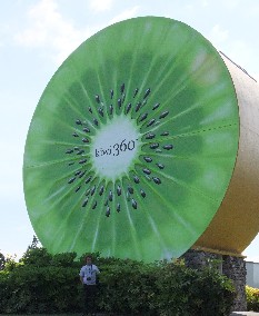 weíre on our way: first withdraw money and then buy some groceries. We find a supermarket in the main street: Countdown, buy everything we need today and for the next days. We load everything to the campervan and have our lunch at about two thirty on the parking with our table next to the camper: sandwiches with two types of tuna from a can, but it tastes OK. We ten drive to Hamilton and Tauranga to reach Te Puke (Kiwi Capital Of the World) via a small detour to go to Whakatane. First we take HW 30, then HW 33 and at five kilometer before Te Puke we stop at Kiwi 360. That is a bar that also organizes kiwi-tours, not the bird but the fruit now. We check it out, take the pictures of the kiwis and the signs and receive some good things we can taste in the shop: kiwi-juice, kiwi-wine and kiwi-fruit. They also make strong alcohol here, but we donít try that. We buy some souvenirs and then drive to Whakatane.
Tomorrow we need to be here to have our trip to White Island, but today we first drive further to Ohope beach. That is long-stretched beach and village and there is also a Top 10 Holiday Park-. We follow the road to Ohope Beach over a low, but steep hill and then drive along the beach to reach the campsite. We can have a space and even can choose which one we prefer. We want site 23, because we had it before and have sea view there, so a nice location to spend the evening. We drink a beer to celebrate that we reached this part safely and then we arrange everything for the rest of the day. Timo starts to write the report and then Eef prepares the food: past with small hamburgers, peas and carrots. Then we do the dishes, head for the camper, write more of the reports, read a book and then at about ten we go to sleep.
Timo had rung the tour operator to be sure that everything would be OK for tomorrow and that is the case: tomorrow we need to be there at 08:45 and then we have a day on the boat to White Island. Our next Volcanic Experience after Rotorua today.
Day 12: Thursday November 11, 2010: White Island, an active volcano
 Today we had booked a guided tour to White Island (Whakaari) and we according to the call yesterday we need to be there at 08:45. Thereís no rush, so we get up at six thirty, have breakfast and take a shower and then at 08:30 itís time to depart fro Ohope Beach to Whakatane: they pronounce it as Fakatane. We again follow the 10 kilometers along the coast, over the hill and quickly find The Strand 15 where we need to be for the check-in. we pay, check some of the safety regulations and sign that we approve them and will observe the rules. No problemo and no worries. We sail today to White Island for one and a half hours with the Peejay V, a boat belonging to Peter and Jenny Tait, who discovered the island as one of the first and they are almost the only operator who is allowed to land on the volcano. Whakatane is located at the river of the same name and itís also on this river the boat is moored. When we enter the boat there is already plenty of people on there. The Dutch people draw all of the attention, because they make a hell of a noise and opposite to what we would have expected we have not seen many Dutch people. Now they are on board, but there are also some nice people. No prejudice!
First we receive some history and general information about White Island. For the people who are not interested you can skip the next two paragraphs. White Island is a large under water volcano of 150.000 Ė 200.000 years old. Itís the most active volcano of New Zealand and is located 49 kilometers north of Whakatane in ĎThe Bay of Plentyí. The name of the volcano in Maori is Whakaari and means ďwhat can be made visible Ė a name maybe caused because on grey days the island is not seen, while it is visible on clear days. Although the volcano lies 321 meters above sea level, the complete height from the ocean-floor is twice as large Ė 760 meters. Only a small percentage of the island is above sea level Ė the visible part if 2.4 k by 2 k, while it is 16 by 18 k at the base. White Island has a special past. In 1914 the western rim collapsed and has cause an avalanche (or Lahar) that kille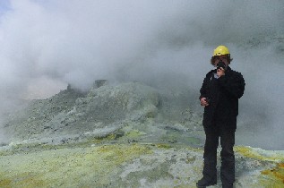 d ten people who were working in the sulfur mines. The mining has been re-established a couple of year later, but has ceased totally n 1933, so the island could be restored to its original shape.
Since 1967 scientists are busy monitoring the activity of the volcano. They could see large ash plumes from the mainland and the last eruption took place in 2000. Nowadays itís possible to visit the volcano as a tourist attraction and you can see the special features from the first line. The moon landscape of the island and the constant volcanic activity make this on of New Zealandís most inviting attractions. The bright yellow colored sulfur-vents, the smell of the volcanic ashes and the thunder of Middle earth under your feet deliver a unique experience. The vegetation on the outer rim is small although there are two species of birds that are prominently present Ė muttonbirds and gannets. Between all these remains of the ancient earth forces there are the remains of an old sulfur factory.
This ends the extra information and history. So we checked in and then walk to the boat and depart on time. Normally the departure was at 09:15 and weíre on our way at 09:20, so well on time. We slowly sail the mouth of the river and then head to the open sea. Where these two meet there is a statue of a Maori-woman, who performed special things for Maori. In short: the men were on land, the women stayed in the canoe. When tide rose the women would disappear into the sea due to the current. One would think: then one of the women should take the rudder and the paddles, but according to tradition they were not allowed to. This woman did it nevertheless and has become a hero, has given her name to the city and the river and now theyíve erected a statue for her at the mouth of the river.
After fifteen minutes we pass Whale Island, although it looks more like a snail, but thatís the name. And the total journey takes one hour and thirty minutes. On our way there 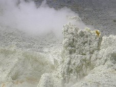 we keep our eyes open for whales, but we only see one or three fur seals, also nice. A snack on board kills time and we arrive on the island on time. Everybody must disembark from Peejay V with a smaller zodiac and then we are divided into three groups. We are with guides Nicola and Lance. The first stops are to explain about the island itself and the history and also about eruptions and stuff. A small stream flows though the valley of the crater and we see a few sulfur-vents that can be pretty hot. We all have a gasmask, because it smells badly here and also a helmet to protect us against falling debris, if anything would happen. Via a few stops with hot water underground and bubbling mud, we arrive at the vent that is the most active these days. From some of the holes in the volcano we see very hot steam rising and it makes a hissing noise and the smell of rotten eggs is everywhere, but that was the case the whole day. At this point we need to pay attention, because it can be very dangerous here. Parts of the volcano can collapse and underneath there is hot mud, so you need to look where you put your feet.
About halfway of the tour we see the main crater of the volcano, because the remarkable thing is that you walk inside the crater. If you follow safety regulations and listen to the guides itís not dangerous. The main crater is a green lake surrounded with white clouds coming from the inner part of the earth. If you walk through a cloud like that, best thing to do it to wear the gasmask, unless you suffer from dementia Ė and there is someone in our group who does. This is then also the highlight of the tour and it looks marvelous. Inside the lake the bubbles are coming up and that changes the color from the lake from dark green to light green. This really is very beautiful. If you look around you can spot white clouds rising from the surface and even al the way on the summit of Mount Gisbourne (the highest peak of the island) you can see small strings of white clouds escaping from the earth.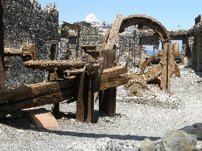
The guide takes us to the highest point inside the crater and you have a stunning view of the whole volcano and then we walk back down to the sulfur-factory. In the past they mined for sulfur here, but now this has stopped completely. Everything is rusted and this is the end of the tour. We can walk around here and then return to the zodiac that brings us to the boat. When weíre on board we get a lunch with a drink and then we sail around the island. We see another seal from a distance and the crew points a school of blue mao mao to us. They swim right below the surface. We also see three large gannet-colonies who have their nests in different corners of the island. Inside the crater everything is white, green and yellow, but here we see other colors, mainly red from the rocks.
Then we drive back to the mainland and again we donít see any whales during the trip. It happens on occasions, but not today. At our arrival at the river mouth we see the two Whakatane Heads: two rocks in the shape of a head, one of a man, the other one of a woman. The crew stops the boat and we get into the camper and drive to Taupo, at least we hope to reach it. We leave immediately to cover the 80 kilometers to Rotorua, which we do in an hour. The speed is here limited to 100 kilometers per hour and in the hills and mountains this can be limited to 50, so that takes down the average. During the trip we always see the dead bodies of possums. They were introduced and now this has reached plague proportions and the New Zealanders have made it a sport to kill them. Every few kilometers you see one, but we have not yet killed one. From Rotorua we drive to Taupo, where there is also a Top 10. We do have the discount card and the campsites have always been good, so we also look for this one.
We follow the volcanic HW 5 to the south and after an hour we arrive in Taupo. We already see signs to Centennial Drive on the highway and there is our target. We check in, get an access code for the gate and can enter the campsite. While Eef takes a shower, Timo writes the report with a beer and a cigarette. Then we cook: hamburgers with some canned ravioli and it is not that bad after all and then we watch the pictures on the laptop. It was an exhausting day, so we can use the sleep.
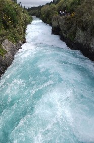 Day 13: Friday November 12, 2010: Theme of the day: Landscapes
Our first and last day is over in Taupo. The only reason why we came here was to see Lake Taupo and to shorten the distance to Tongariro National Park and Wellington. We start our day quiet because we have plenty of time to reach our destination today. Fist we have breakfast, wash up and then leave with the camper. We had received an access code and also need to use it today to exit the park. Before we leave Timo calls Interislander because with the Top 10 card you also have a discount of ten percent on the crossing from North Island to the South Island. We certainly need to make arrangements for that, because that is almost the price of the card itself. They say they can reimburse the credit card when we show the card at check in. In general Top 10 are a bit more expensive, but with the discounts every time and the one on the Interislander it is still relatively cheap.
Before we drive anywhere we need to fill up diesel: there were only two blocks in the gasoline indicator since yesterday and we have a long distance to drive today Ė again. Today weíre going to see Mount Doom and Mordor from the Lord Of The Rings, so it must be worth it. First find a gas station and we find one not from the camping. Then weíre going to check out the lake. Normally you can see the mountain range from Tongariro National Park, but itís cloudy today, so it does not work out that way. The lake is impressive, because it stretches over several square kilometers: about 30 by 40, so that is a big surface. We take some scenery pictures and then go to Huka Falls. Those are a couple of kilometers back to Rotorua, but we did not have time yesterday. Eef is driving today, because Timo wanted to enjoy the scenery. When heís driving he can do that a bit, but in the mountains where the landscapes are the prettiest, he needs to pay more attention to the traffic and the road; a responsible driver as he is.
To Huka Falls it is. We first read the information sign and that tells us that there is a flow of 200.000 liters per second. That is amazing and especially if you see the small canal it is being pumped through. It flows down with very high speeds through a canal of about 60 meters long and only 10 meters wide and then the water plunges down nine meters in the wider part of the river. The water is ice blue and on the p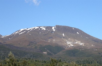 laces where itís swirling snow-white. It is a pretty sight. We walk the small canal and then take some pictures, but on the pictures it does not tell the whole story of reality. We are really impressed by this scenery. If you pass here it is really worth the visit. It is as a consequence one of the most visited sites in New Zealand. A little bit down the road there is ĎCraters of the Mooní, but weíve seen enough of volcanic activity in Rotorua and on White Island that we skip this now. Had enough of boiling mud and rotten eggs.
Then we drive to Taupo and pass the lake again. We could have stopped now for the views, but we had to drive past the lake when returning from the gas station, so we just drive south and more specifically to Tongariro National Park. The first part is 50 kilometers far to Turangi. There we take HW 46 via Rangipo to the entrance of the national park. When we start the highway we already see a mountain covered in clouds and that I mount Tongariro. According to some people this is Mount Doom from the LOTR, according to others Mount Doom is Mt Ngauruhoe. We canít see the summit, but judging from the base it could be either one. It is impressive even though we canít see the entire mountain.
The landscape is also completely different than before. On the plains in front of the three volcanoes (there is a third one: Mt Pukekaikiore) long grass grows, looks like long blades of straw or a special kind of palm tree, not really a tree with trunk or palm leaves, but only long stretched leaves growing from the fertile soil; itís something special. We still canít see the summits of the volcanoes, but see that there is at least one that has snow on it. Thatís not remarkable, because there are several ski lifts, even this time of the year. The high season has finished, but there are loads of people still. We have approached the mountains from the north and drive all the way at the western side to the south. At all times we see the mountains and Timo loves that heís not driving today. We stop several times and enjoy the view. Our first real stop is Whakapapa Village, about six kilometers from the main highway. There we check if we can do a short walk. We donít really want to do a full day hike, because for that our time here is too short. We prefer Ridge Track. On one sign 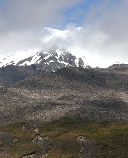 it states the walk take 30 to 40 minutes and another one at the beginning of the track says about one hour. Weíll see.
We start at the visitor center, walk 150 meters upwards and start the track. The first few hundred meters is through native forest, itís nice and cool. Although there are many clouds that hide the summit of the mountains for us, the temperature here below is pleasant. The sun shines and itís 22į. We have a quick pace and it climbs until you have a great view on the different mountains. The path leads straight to Mount Ruapehu, Mordor from LOTR. We get to see more than one filming location of LOTR on one day. Also the Plains of Gorgoroth have been filmed here. We enjoy the magnificent views, because once weíve traversed the native forest we end up in a bare landscape with small grasses, little bushes, succulents, but breath-taking sights over these plains. Itís not an actual flat plain, but rather slopes, but in comparison to the volcanoes itís a plain. Mount Ruapehu for example if 2797 meters high.
We walk the track till we reach a round table after fifteen minutes and we think this is the end of the track, but we follow a continued path higher to the top of the slopes, because we assume the view will even be better there. And we have guessed correctly. In one glance you see all of the mountains (covered in clouds) and that is really fantastic. A bit further there is a large green plain covered with white dots and every dot count for one sheep. The views are unbelievable and you should pass here only for that already. First to see the mountain range, secondly for the walk and certainly if youíre a LOTR fan you need to come here. Still you need to have some luck with the weather, which was not for us, but we are already amazed with this view of mountains and clouds. Weíve walked for about an hour and then return to the camper and then drive to Ohakune, a small village at the south of the park. We see all the time Mount Ruapehu at our left side and a few times the snowy summit is visible. Yes, this is marvelous.
The drive from Whakapapa Village to Ohakune is a bit over 50 kilometers and it only takes us half an hour before we reach it. We stop a few times, because we think the landscape is impressive, I canít think of enough words to describe this. We first would have thought to stay for the night in Ohakune, but itís only 13:30 and there is not much to see, so we have our lunch and drive further to the coast, to Wanganui. There will be more to see and weíre 100 kilometer closer to Wellington then. The HW 4 takes us south and Timo names this The Scenery Highway, because he picked a very good day to be the passenger and enjoy 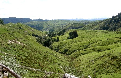 the shooting landscapes. The sloping hills with the sheep, the green spring grass, the valleys, the mountains and the rivers: everything is beautiful here. We drive over tens of bridges, large and small ones and every bridge in New Zealand has a number and there is a sign at every crossing of a brook or river. We also stop to see falls: Raukawa Falls. We see the falls falling down from a high cliff, between the green hills, an amazing view. This is New Zealand like we had imagined it would be.
The rest of the road to Wanganui is not really of any interest. We donít see any villages and for 100 kilometers we donít see any gas stations: luckily we filled up in Taupo. We just stop one more time at the side of the road to look at the hills and enjoy the view one more time. At 15:45 we arrive in Wanganui and donít stop at the lookout. We had enough views today. But we are enjoying every minute and second weíre driving here. At about four we arrive at the campsite, get a powered site and got there. We have a beer and swim for half an hour in the pool. This is really nice. We first need to remove the cover before we can swim and need to put it back afterwards. Then we take a shower, Eef uses the Internet and Timo starts writing the report again and itís pretty long again. Then itís time for dinner. We bought food in Ohakune between the ski-shops, the AprŤs Ski Lodges and Timo will prepare the meal. Weíll see what he makes of it. We eat steak with Ďmashed-potatoe-flakesí and mushrooms. It will be good, because Timo makes the best of it. First we enjoy the sun, then we eat, check what weíll be doing tomorrow and then we go to sleep early in the camper. Weíve never stayed up late, but weíre awake early in the morning as well. Usually at six we get up and leave already at eight.
Tomorrow we drive to some filming sites of LOTR and head to Wellington to cross from North to South. Then we say goodbye to the North Island, but we still have a lot of time to spend on the South Island. If that is as good as the North, then we can expect two more fantastic weeks. And guess who we saw when Timo was cooking: of course again the Englishman with his wife and his Australian friend and his wife. It seems like theyíre stalking us. About nine thirty we go to sleep after looking at the pictures of the day. Goodnight.
Day 14: Saturday November 13, 2010: Theme of the day: The Lord Of The Rings
The weather is not very good when we get up today. Timo first checks the oil level of the camper. It was a requirement when renting the camper to do that every 500  kilometers, so we check it then. Everything is OK, so we can leave without a problem today. We prepare our breakfast: coffee, bread, p‚tť and Eef has cornflakes. Wash and then we drive to Wellington. It is about 200 kilometers, so weíll be in the car for quite a while. Thatís part of the vacation. We donít want to do a lot of things in Wanganui itself, so we drive direct to the south. To the south: that would mean better weather, but not here, because we move forward in the fog and it is raining all the time. The more we head south the worse the weather. We fear that the crossing tomorrow will be not so good. If the weather is so bad you donít see a thing and the crossing should be very beautiful. You canít really come back only for that, although, maybe it might be needed.
We follow the HW 3 to Sanson and then we can choose either to Palmerston North or Wellington. We take the HW 1 to Wellington. There are not many landmarks on our way today and also Tourism Radio is not giving a lot of info. So we listen to a CD of Grinderman. It does not bring us in a better mood, but now we can listen to something else than the singers on the radio. Our first stop must be Upper Hutt, because there were many film locations of LOTR. This is not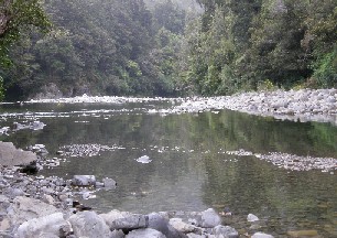 the main reason for our visit to New Zealand, but now weíre here, we can go and see. We stop at the I-site of Upper Hutt and receive some general info about these locations. We also get a map of Upper and Lower Hutt and Wellington, which can come in handy.
None of the sites can be done on foot and the rain is still falling. The mood of Eef has dropped like the rain is: slowly but steadily down. Good thing itís not freezing yet, otherwise the atmosphere would be really down. Along the shores of the River Hutt there were plenty of scenes filmed, for example in Harcourt Park and Poets Park. We stop in Harcourtís Park, but we donít actually recognize a lot, maybe itís us, but we donít think so. We walk through the park to the river and then turn back. Itís already past lunchtime, so Eef has a snack and weíre on our way to the next stop: Rivendell, because we donít stop in Poets Park. This is one of the few locations of LOTR; except for Hobbiton of course that has clear signs to it. We need to drive to Kaitoke National Park and there is a clear sign to the forest where it was filmed. Rivendell was a place for elves, for people who did not see the movies. The way to it is beautiful and there is a big sign at the filming location itself, but you need a lot of fantasy to recognize the scene from the trilogy. We find it very hard.
Then we drive to Lower Hutt, because on our way there we need to stop at Helms Deep. This was in the movie the place where the humans could find shelter and could defend themselves against the Orcs and other enemies. It is located at Haywards Hill Road in Dry Creek Quarry. This is a mining company where not tourists are admitted, so it has no use to stay here long. These were the most important things for which we came to this region and to be honest, you could call it a disappointment. Only the River Hutt, you can imagine this being used in the movie. You can see the location where Arwen had flooded the river, but more you canít tell about it. In the end the actual flood was not even filmed here.
So we get back in the van, pass by Lower Hutt, pass the exit for the ferry Wellington-Picton (see tomorrow) and then stop in the city of Wellington. We stop here to pass some time in the city, because otherwise weíre stuck in the camping and itís still raining, foggy, so the weather is not good to drink a beer outside. We easily find our way in Wellington, but finding a parking sot for the camper is something else. We look and find parking, not underground, but we need to pay and we donít have any coins. There are a few ladies washing cars, but they canít change anything and the pay point does not accept credit card, so we donít bother too long. We donít take the risk of not paying, so we donít stay in Wellington. Weíre not city loving people anyway and the weather is still bad and the mood of some persons is still dropping. Then we drive to Lower Hutt to tank, to buy groceries and to go to the camping.
It only takes us fifteen minutes to get to Lower Hutt and thatís nice to know for tomorrow morning, because we already need to be there at 07:25 for the latest check-in. We find our way to the campsite, and then drive back into town to buy some groceries. We manage well; locate a supermarket and a gas station linked to the supermarket, so we find both close to each other. We buy food for tonight and for tomorrow, so we donít need to stop for food very day. Timo finally buys tobacco, because normal cigarettes are very expensive in New Zealand. A normal package costs at least 14 NZD, about 7 Euro, which is ridiculously expensive compared to Belgium. Timo buys Holiday Menthol Tobacco and is curious what it tastes like. Immediately when he co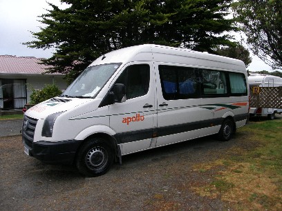 mes out of the supermarket he needs to try it out and itís not too bad. And not extremely expensive, although 25 NZD for leaves and tobacco is enough.
From the center we already know our way back to the camping and check in. Timo already called when we left Wanganui to reserve a powered site and it was booked for us. We wanted to be sure we had a site available; otherwise we could still be looking for a camping. We notice that the more you drive south the more expensive the Top 10 Holiday parks become. Letís hope that will not continue on the South Island that way. This camping with the ten percent discount is already 39,60 NZD. The cheapest Top 10 was 32 in the far north, so that is a difference of 7 NZD. We noticed this already in Taupo, but we thought it was because that camping had 5 stars. We get site 12, again an access code and find the spot with a short detour. We hope it stops raining, but no, itís still is and it does not look like itís going to be any different tomorrow. The forecast had predicted three days of bad weather and this is the first one. Maybe we need to start thinking about the dives in a couple of days.
Since the weather does not permit us to stay outside, Timo writes the travel report in the camper and Eef goes to the TV room to read her book. Then itís time for a shower, first Timo, then Eef and then Timo starts to cook. Today we have a menu of sausages, coleslaw, tomatoes and the mashed potatoes of yesterday Ė still some left to prepare. Timo thinks it has no added value so does not eat it. It is nice without the potatoes, especially because there are fresh vegetables included now. That is different from previous meals. We like it with capers, balsamic vinegar and oil. After doing the dishes we return to the camper and itís only 21:30 when we go to sleep. We need to get up early tomorrow. Iím curious what the crossing with the large ferry will bring. Weíll see what happens tomorrow. Sleep tight.
Day 15: Sunday November 14, 2010: Ferry North Island South Island, Abel Tasman National Park
Today is an important day. The chapter of the North Island will be closed and the chapter of the South Island can start. The North Island was marvelous, great magnificent. A few highlights must be mentioned: Rotorua with the Maori and the Maoriís, The Poor Knights Islands with the dives, White Island, landscapes in general, The Lord Of The Rings, Ki wi Encounter. I must now stop, because otherwise I could mention everything. Every meter here in New Zealand is a good one; you can enjoy every centimeter, every meter en even more every kilometer. Although you canít compare the distances with Belgium Ė youíre in a camper a lot of hours Ė it suits me better than what I would have hoped. Weíve been able to reach all our destinations on time and I hope that will stay that way. Today we leave the North Island with the brake pad issues, but also with the mountains, the beaches, and the dives as I mentioned before. This is a short summary of the North Island and now we head south. Quote from LOTR: Treebeard: I always like going South; somehow, it feels like going downhill.
We booked the ferry Wellington Ė Picton from home already, which is the most advised way of doing it, not only in the peak season, but also now. The ferry leaves at 08:25, last check-in at 07:25, so we need to get up on time and drive from Lower Hutt to Wellington to the ferry Interislander. First we drink a cup of coffee to wake us up, close the gas in the camper. Yesterday we had put the heating on, because at night it can be cold. Eef did not need it yesterday, but the gas tank was open and needs to be closed when driving. We then get ready and leave for the ferry at a couple of minutes before seven. The ferry terminal is only fifteen minutes away from Lower Hutt, from the campsite we were on, so thatís good. At six in the morning itís very busy already, because everybody on the camping needs to take the first ferry of the day. So we go to Wellington, take the exit for Ferry Picton and follow the signs for the Interislander. We already see the white ferry with the blue and green, chimney in the harbor.
We drive to the vehicle check-in and need to wait a while. Of course we had chosen the wrong queu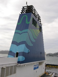 e, as always. When itís our turn, everything is done quickly and Timo asks how it has been arranged with the TOP 10 discount. Itís already back on the Mastercard, the guy tells Timo. Thatís great, what a service! Everything is according to plan. We follow lane 2 and can cut the queue. Timo! Pay attention because the lanes are very narrow here. On to the ferry, hand brakes on vehicle in gear and then find a good spot for the crossing of three and a half hours. Thatís pretty long, but according to many people and tourist guides, this should be one of the most beautiful ferry crossings in the world. Weíll judge about that. If you look at the map and see that we sail between fiords and sounds that could be correct. We sit down on deck eight and have a coffee: large black and eat our breakfast. Eef had just before we left the camper prepared a few sandwiches in the dark (with her headlight) to make sure we had something to eat during the crossing.
We can enjoy the view on Wellington when we found a seat. No rain today, no low clouds, but high clouds with the sun coming through on occasions. Thatís the weather we prefer. At departure we check on the harbor of Wellington and say goodbye to the North Island. And from that time onwards all eyes are set to Picton. The village itself is not really special, except for the few hours when a ferry departs or arrives and thatís a few times per day. Apart from the Interislander there is also Bluebridge, another company that arranges the crossing. During the crossing we pass time with checking and changing the preparation, reading a book, but thatís not an issue, because you donít get bored for a second during the crossing. We have just sailed out of the harbor and then we reach open sea, then we re-check the planning and when thatís done we already reach Marlborough Sounds. The national park starts here and the view is stunning. A ferry with ten, yes ten, deka, zehn, dix, desjat floors, sails in these beautiful landscapes. Along the green slopes, long marvelous bays, and in between small islands: the ferry entertains the passengers. Itís a perfect view. Timo had expected a lot from the ferry crossing, but it comes up to his expectations, because itís so pretty, unbelievable. I think Iím making everybody jealous now.
The crossing in one word is splendid, magnificent; breathe taking, unimaginable pretty, damn, thatís more than one word is it? Picton is a small village with a small harbor and the captain needs all his skills to park the huge ferry. Timo meets the two divers who e also met in Rotorua and chats with them. Then everyone needs to return to his or her vehicles, camper, car or similar at the lower decks to get out of the ferry. We were parked on deck 3 and return to the camper. We can leave after a few minutes. Everything is arranged very well and it goes fast. Timo lets one camper i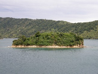 n front, but the next one needs to wait, although he was really pushing to get in front. Everything goes well, especially knowing the ferry was almost full and after ten minutes weíre on our way from Picton to Motueka. That is a city near the Abel Tasman National Park and we want to stay there. Not like we first planned in Blenheim, because then the trip to Abel Tasman would take to long.
We follow the road to Motueka via Nelson, not directly via Havelock, but we do a short detour via Renwick and then drive between the vineyards, which is really beautiful with the mountains in the distance and the long rows of vines that are planted in perfect symmetrical rows, again magnificent views. I canít find enough words to describe this. The road goes through the mountains, but itís not really hilly and takes us to Havelock. Just before that we passed Canvastown. Jurgen needs the time to go there once in his lifetime (a friend who works for Canvas, Belgian TV). Then further to Nelson and just before that Tourism Radio says the Pelorus Bridge is a nice place for a picnic. We see it and are a bit hungry, so we stop and have lunch: coleslaw, cheese, capers, ketchup, balsamic vinegar and it does us well. We had nothing to eat since eight this morning and itís normal that youíre hungry then.
After the picnic we drive through Nelson, but donít stop there, although there are some things to see there, but drive on to Motueka via Richmond. After a drive of a couple of hours we arrive there at 15:40 and fin d without problems the camping of Top 10. We check in for two nights and they advise us to do a trip to Able Tasman National Park tomorrow. They will pick us up at the reception, then drive with a small bus to a village at the coast and then visit with a water taxi several beaches, a seal colony, drop us of at Bark Bay and then we walk to Torrent Bay and there the water taxi will pick us back up to bring us to Kaiteriteri and then back to the camping. We book this trip and look for a nice spot on the camping. We prefer a quiet place far away from the reception on site 16. There is a bench where we can sit, eat and drink something. Thatís the first thing we do: have a beer. Eef then takes a shower and Timo walks into town to withdraw money and buy bread and beer, because weíve run out. He finds a Countdown and gets a discount with the card of Apollo of six NZD. The walks by The Gothic, a restaurant that is for sale, so Goth-people, go to New Zealand and have something to eat, because Timo has found the business to take over. Back at the camping we have another drink, write the travel report and rest a bit.
At about eight we get hungry and have bought a nice meal yesterday: pasta with strings of bacon, sauce carbonara and eat very good. We do the cooking together and then eat outside, because the weather is still very good. We think the temperature is still 18į and itís already 20:39 when Timo is writing this. Then it starts to get darker, but not cold. We will be able to enjoy some good weather, because the lady at the reception has said temperature will be 18į tomorrow and a bright sunny day. Timo also took a bottle of red wine and that is empty by now. After some beers and yet another one now, while Eef is acting silly and taking pictures of bottles of beer. Iím going to stop writing, because this will lead nowhere now. Eef is taking pictures of the bottles with all settings and with the different cameras and acting silly all the time. Then we go to bed, because itís getting late.
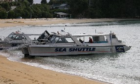 Day 16: Monday November 15, 2010: Abel Tasman National Park
Yesterday the lady at the reception talked us into a trip to Abel Tasman. We will do the whole route of the national park by boat and a part of foot. We have four hours to cover the 7.5 kilometers, so I would say that should be all right. The pickup of Sea Shuttle, Discover Abel Tasman is at 08:30 at the reception and they arrive on time. We make sure weíve already had breakfast by then and are ready to start the trip. There are nine people on the trip from here and the driver takes us to Kaiteriteri. That is about ten kilometers from Motueka and we reach it in less than fifteen minutes. We immediately receive our boarding passes: we each get one for our departure and another one for our way back. Our guides today are Ali and I canít remember the other guyís name. They take one of the boarding passes and we can board the small catamaran, the Abel Dominator. There are many people on the catamaran, in total about 70, if I can estimate it well and weíre directly ready to leave.
We can tell from the color of the sand here at Kaiteriteri Beach that the beaches are very beautiful; they call it Golden Bay and the sand is golden, which provides a beautiful contrast to the hills behind the beach and the village. The vegetation of these hills is all native bush. What does that mean? A bit of everything, but mainly what strikes are the huge ferns and the large trees. That is at least what we see from the boat. The first stop on our route is Split Apple Rock. This is a large boulder lying on a rock just above sea level and is split into two pieces; it remarkable that a boulder that size (a diameter of three meters) is split into two. Close to the boulder there are many cormorants that have their colony on the Ngaio Island close by. Also o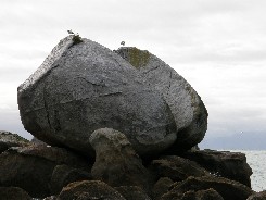 n land they have found a place to build their nests. There are about 50 birds and most of them are on the nest or flying back and forth with food for the breeding birds. This is a good start of the day.
It will not become a great day as was forecasted, because there are many clouds and there is little sun. We sail to the first dropoff of the day: Anchorage. They drop a few people there and five minutes further also in Torrent Bay. That bay will be the pickup bay and last stop of our walk where they will pick us up at 15:30. Between Torrent Bay and Bark Bay (our drop-off) there is a small islet, nothing more than a few rocks. But this is the home of a fur seal colony. You can hardly call this a colony, because there are only five animals. But from the catamaran we can see them clearly, because we quietly sail by. The furs seals are sunbathing, so you could describe this as a busy day at the colony. They donít do a thing, not easy for a human being. Next to the seals there are again cormorants and gannets. A lot of them are in the sky and from time to time you can see them diving in the water in search for fish. At Bark Bay again some people are dropped off and time and time again itís the same exercise. They take the boat to the shore, put the anchor out and people can use the footbridge to get off. This is very luxurious, because you donít need to make your feet wet. The catamaran needs to drop the anchor a long distance before the shore, because it also serves to pull the boat away from the beach.
We see Tonga Bay and Tonga Island again with bird colonies and then also Awaroa Bay. A lodge is located here and a few people want to spend their afternoon in the luxury of a lodge and donít do a walk in the park. The majority has kids. The last and most distant stop is Totranui. If they drop you here you need at least three days to do the whole trip on foot. We donít do that, but turn back to the previous beaches. On Tonga Island there is another stop, not to drop off people, but to see the second seal colony here. There are a bit more seals; about ten and they are still doing nothing like the other ones on Pinnacle Island. Weíre on the boat a long time and have enough. First we found a seat at the back. Timo thought there would be no wind, but we were sitting right in the center of where the wind blew and also had some bad luck, because the water came over the edge. If we would have stayed there, we could be swimming in our clothes. We move in order to stay dry. At 11:30 we finally arrive at Bark bay (also called: Medlands Beach) and there the most people disembark. There are a few people that remain seated: they did not want to walk, but just see the national park from the sea.
From 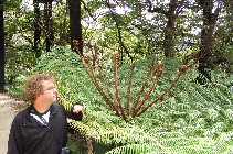 this beach we can start the walk of about two hours and we have four. We walk up the hill and then choose left to Torrent Bay. We quickly eat a sandwich that we brought with us and then we go. Already after fifteen minutes walk through the forest that sometimes is dark and sometimes light we see an Ďexití to a point of view. The difference in light and dark forest mainly is caused by the type of vegetation. It consists of different kinds of ferns reaching from the ground to over four meters high, but also small ones. The leaves hold the sunlight and therefore the soil is moist and dark. The lighter parts are covered with small trees with only a few leaves and branches and there the light can still penetrate.
We follow the sign to the point of view Ė five minutes. This is North Head. From here you can clearly see the neighboring bay and the Pinnacle Island. The view is magnificent and itís really worth the detour. During the walk there are many locations with a view on the bays, on the sea and the small islands close to land. It is beautiful. A little walk further there is a second detour to Sandfly Bay. The name says a lot about the flies on the beach, but we have insect repellant: the good stuff from the outdoor shop. We do the difficult descent to the beach, and see the beautiful golden beaches on our way down. The beaches fit perfectly in brochures of exotic vacations, even when the sun is covered behind the clouds. We can stand the sand flies, so we enjoy the magnificent view. We have a snack and drink some water and enjoy.
One of the cormorants is with a lot of noise and clapping of his wings trying to catch a fish. We notice he manages to catch some. At the edge of the beach there are large boulders. When they are closer to the water there are more and more dark spots on the boulders. These spots are colonies of little mussels. We start to think that everything here lives in colonies. We then turn back and need to climb up, not just a normal walk and reach the main path and we walk on south and to the left. In the trees we only hear the singing of birds and the creaking of trees and the rustling of leaves. Itís a perfect place to relax. Half way down the track we reach a large bridge. Itís a suspension bridge and a Dutch lady right in front of us has problems. I think she does not like heights. Very quietly, step by step she reaches the other side. What a suffering. We also cross the bridge and take a couple of nice pictures of the bridge and the river beneath. It is magnificent, but we canít stay on there too long. There is a limit of five people at the same time on the bridge.
We walk through the dense forest that sometimes is dark and sometimes lighter. We even discover there is a dark black large fern, black veins and green leaves, that is remarkable. The path is a good one and it winds through the hills and the valleys up and down to small bridges and rivers; itís a feast for the eyes. Add to that the fact you encounter a small bay or beach with the beautiful golden sand and you can imagine the landscape of this track. People t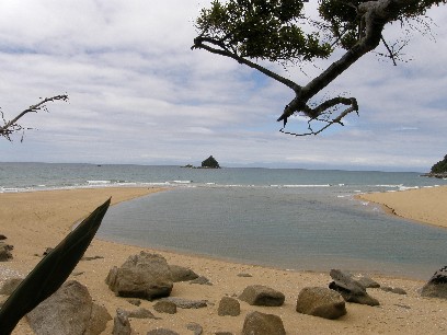 old us this was the best part of the three-day-track from north to south in the Abel Tasman Park. We walk slowly, because we have plenty of time. We donít want to reach our destination early to just sit there and do nothing. We cross a few rivers and use the small rocky path through the native forest. Sometimes we stop for a nice view and then we move on. Itís pretty busy on this track, especially the first half hour. Then we see more people than animals. Two hours early we arrive at a point with a great view over Torrent Bay. This is also the spot for our pick up. We stay here for a while and enjoy the view. Timo can take a few good pictures of a finch and some other birds.
We stay here for half an hour and look at the sea and the beach and all the birds that pass here. One of them is very pretty with a light-green plumage and white rings round the eyes, a small but very pretty bird. Then we finish the walk to the beach and arrive at the bay. We see mini-fish swimming in a creek. When weíre at the beach we see the water rising. It was low tide and now we see it rising and notice that a few sandy islands are being covered with water again. We stay here for half an hour and the Timo hears the sound of a boat. The catamaran of Sea Shuttle arrives and continues its direction away from us. First they pick up people at Anchorage and then they come to us. We have really enjoyed the views, the walk and the beaches and the bays: it has been a lovely day. Only the weather was not so good, the clouds have covered the part where we were walking. We see that the beaches to the south are sunnier and we like that a lot: now we can warm up again.
Via a few stops we arrive in Kaiteriteri again at 16:30. That is half an hour later than planned, because the guides were still looking for Georges. We know how it feels to loose somebody and we hoped that it was not happening again. So we go back to Anchorage to look for him. Yep, itís like that again. Luckily itís not, because there is an announcement on the radio that ĎGeorges is homeí. Nice. We can then return to the harbor and from the harbor with the bus to the camping and we have a beer, because that has been a long time. Eef goes out for shopping, Timo keeps himself busy and then its eating time. We donít go out, but cook something. We have fish sticks and potatoes cooked on the barbecue. Almost all campings have a barbecue on gas: lovely. We did not use it before, but today we do. And it tasted good. Fish, potatoes and beans. We have some wine with it from the supermarket and the evening is ending well. Now some info to Maurits: also in New Zealand the wind stops at seven. We check out the pictures and go to bed at 21:30.
Day 17: Tuesday November 16, 2010: Hit the road for Kaikoura
It is now 17:30 in Kaikoura and I ask myself where I should start. The sun is shining; itís 25į and no wind. Everything is here to make a person happy, that with a menthol cigarette and a TUI, New Zealand ale. Well, letís start at the beginning then. This morning we get up in Motueka after a nice day at the Abel Tasman National Park. It was cool during the night, but not really cold. At 06:30 there is nothing to see at the camping, only Timo takes a morning walk. Not much to see, so back to bed and rest for another half hour. At seven itís time to get up and have breakfast. Timo makes the coffee and we can have breakfast, still in the shadow, warmly dressed. The sun is not over the 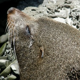 trees yet, so the temperature is not yet what it will be the rest of the day.
After breakfast we do the dishes and leave at eight. We need to fill up the water in the camper, so that is the last thing we do here in Motueka. At 08:10 weíre on the road already for about 300 kilometers to Kaikoura and it will be a pleasant transfer. The first few kilometers to Richmond provides view over a riverbed and there are many herons. We stop to take some pictures, but the light is bad so itís not working as we want. Weíll see the herons later on probably. The way to Richmond is good and then further to nelson too. After Nelson the roads goes up and down and that takes more time. In addition there are road works every few kilometers. Over a distance of 50 kilometers we need to stop several times for a traffic light or for a guy holding a STOP-sign. It takes a few minutes until every car or truck has passed the works and therefore we loose some time. We take the same road as earlier to Canvastown and Havelock to get to Blenheim and several road works and then finally reach the HW 1 to Kaikoura. In Blenheim very large vineyards enhance the view on the green hills. We notice that the hills are less spring-green than before, but rather brown, but it stays pretty.
The vineyards are made in a symmetrical form and we like traveling in New Zealand with these views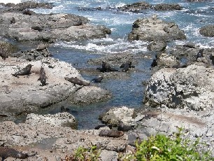 . Then the trip goes faster, we have left the mountains behind us and can drive 100 kilometers per hour almost all the time. Until the drive is again interrupted by ... what do you think ... road works. It starts to get on our nerves. But then we receive a nice surprise. Lake Grassmere is signposted, a salt-making-lake that is totally pink. It looks nice, but we donít have a good spot to stop the van. From this point on we always see the white summit of the Kaikoura Rang: a mountain range in two parts: Inland and Seaward Kaikoura Range. One of the peaks reaches 2885 meters, the Tapuaenuka. This is visible all the time, even from Blenheim and we see the snowy peak in front of us or at the right side. Itís pretty and pleasant to see and enjoy this with 25į.
From the small village of Wharanui we arrive at the coast and weíll have a coastal road all the way to our destination. Suddenly we must stop, because the view is now stunning. We drive next to the sea with a black sandy beach. At the right side the green hills, at our left side the black sand and the blue sea and in the distance the green hills and the black mountains with the snow-white peaks. ThŠt is a view; weíve never seen this before, so close to the sea such high mountains. The blue of the sea is in beautiful contrast with the black sand, the green hills, the brown mountains and the white snow of the peaks. This is marvel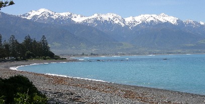 ous, magnificent, splendid, but itís not the first time I write this. This even beyond our wildest expectations. Yeah right! Now imagine this landscape and enjoy with us. We drive on a road-work-sensitive HW 1 and suddenly we see cars and vans next to the highway. Timo yells: Eef, seals! Eef looks aside and confirms, but we canít stop, so we drive to the next picnic spot 200 meters down the road. How lucky we are!
We put the car at the side of the road and watch the scenes. Yesterday we had heavily search for the seals, but here the rocks and sea are full. We start a count and stop at 30. This is seal colony and the one from yesterday was only a rock with some seals. We take pictures and can approach some seals very closely. This is really an amazing experience. And so close to the road. The smaller cubs are a bit further from the road, but with the high zoom function of our cameras we can bring them closer. They are on the rocks and everyone who is here, is full of surprise there are that many seals. This is marvelous, magnificent, splendid, but itís not the first time I write this. We continue a bit further and after 5 kilometers stop again, because there are even more in this bay. There are hundreds. The oldest and fattest seals are on the rock and the cubs use the pools between the rocks as their playground. The waves roll over the rocks and they form the pool. We then look up and see the snowy mountains. This is only to illustrate that the east coast of the South Island has things to offer.
We continue to Kaikoura and Timo feels only relaxed when he was able to fill the camper up with diesel, because the last light on the dashboard was blinking and we first need to find a gas station. That is indeed the first thing we do in Kaikoura. Then we drive back on the HW 1 to take a picture of the blue water, the green and brown hills and the snow-covered mountain peaks. This is one of the most beautiful things weíve ever seen. Then we go back to the center and easily find the Top 10 and check in for two nights. We did not stop in Blenheim for diving, so we arrive one day early here and makes the busy schedule a bit easier. Weíre on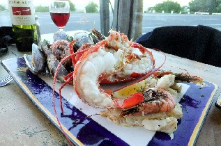 site 30 and have lunch, before we pass the rest of the day here. Eef goes for a swim and Timo walks into town. Itís a pretty big one. He goes to Dive! Kaikoura, but itís uncertain that he will sail tomorrow, because the Ďvizí is not good. It takes Timo one and a half hours and meets Eef at the camper and sheís enjoying the sun and her book.
She wants to do something, so we walk back into town, stop at the Whale Watching station to change the booking for the trip to tomorrow. That works out without any problems. Itís still low season, so not all boats are full yet. We cross the river and then have a drink in a bar; a local ale of the South Island. Itís a little bit darker than a normal beer, but it tastes good. The color is comparable to Geuze, but it tastes more like a normal draught with a bit more flavor. We then look for a restaurant where we can have crayfish tonight: thatís one of the things Kaikoura is famous for. Next to HW 1 we saw lots of small booths with publicity of crayfish. We prefer ĎThe Sonicí for tonight. After the beer we return to the camping, enjoy the sun some more and take a shower to wash away the tiredness and the beers. Timo writes the report in these sunny circumstances. Until now Kaikoura was great. The food and the whale watching should also meet expectations. Thatís for later.
At about 18:30 we want to eat something and walk back to town. Like I said we prefer ĎThe Sonicí and take a bottle of red wine and order seafood platter. This consists of one crayfish (half one each), about ten mussels, shrimps and two scampi per person. It tastes very good and this is a perfect end of a very good day. In total this costs 157 NZD. That is about 78.5 Euro and is not so much if you see what we ate and drank for that price. We have a view on the sea and on the other side a view on the mountains and the setting sun against the snowy mountains. That also is a beautiful sight. We drink a glass o wine at home and then go to sleep. Especially Eef had enough to drink today and we close a perfect day. We did not expect such a beautiful landscapes, so many seals close to the road and the bad things easily get forgotten: the road works. We fall asleep right away, because weíre tired.
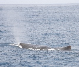 Day 18: Wednesday November 17, 2010: Kaikoura Whale Watching
Before noon there is nothing much to do: wake up, groceries, have breakfast and nothing else. We need to wait until 12:15 to take the trip with Whale Watch Kaikoura. We had planned this as a highlight of the vacation, but weíll have to wait whether this will become a highlight or not. The groceries can be done not far from the camping in new World and we mainly buy food for tonight and tomorrow. We encounter Kristien n our way there: we met her during the dives in Tutukaka. He has reached Kaikoura as well with her two kids. Itís not easy to travel New Zealand with the twins, but they do the whole trip of the North and South Island. So we spend some money in New World and then go back to the camping. Weíve got things to arrange there. We clean the van to make sure it does not get too dirty, especially when you live with two people on a couple of square meters. Weíve liked it better than we would have feared. Look for another camping every day, learn to know a new city or village every day, but itís been good so far. Having vacation together with Eef is a habit, but in different circumstances, but that has been good as well. I really appreciate her company, everything is going smooth.
When we came out of the camper this morning, the weather was not looking good, clouds over the mountains, at the lowest part of the mountain and we wonder if the trip is not going to be cancelled. When weíre on our way to the supermarket, the weather gets better: the sun shines and everything is starting to get warmer. After we had an early lunch the clouds start coming in again. Itís only spring here and you canít expect that itís 30į every day: even in summer this is not always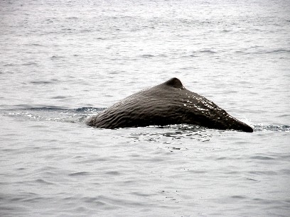 the case. The most important is that no trips are being cancelled or even a crossing from North to South or similar. Weíre getting a bit nervous, because the intention is to spot whales. At least we hope to see one whale and hope to take one or two good pictures. Did we know?
Way to early we walk the one and a half kilometer to Whale Watch Kaikoura to wait for the check-in. First we wait a bit and the check-in starts at 12:15, but at least weíre on time. Check-in is fast: we receive two boarding passes and need to wait inside the building in the briefing room. There we get a briefing (yeah, of course why would they call it a briefing room?) about the safety rules and regulations on the different boats. We have tickets for the Aoraki, a catamaran, just like the other four at their disposal. We do need to wait until 12:45 for the briefing that takes only fifteen minutes and then a bus takes us to South Bay where all boats are. That takes another ten minutes. We get from the bus on the catamaran, at the rear, which is better for motion sickness.
All right. Eventually we wait for about an hour, get briefed and then we can get on the boat to the grounds where the sperm whales are. In Dutch theyíre called Ďpotvissení. The main reason why these animals come here is for the dept. Only ten minutes away from shore the sea reaches a depth of 2000 meters. On land the mountains rise up to over 2000 meters as well, so on a distance of a couple of kilometers there is a difference in altitude of 4000 + meters. Thatís incredible. During the trip tot he whale grounds we get the briefing a second time and receive some general information how they spot the whales. Important are the planes and the helicopters and apart from that they use hydrophones, under water speakers that capture the sounds of the whales and the skippers can clearly interpret these sounds to receive correct information where the whales are and where they will surface eventually. Currently there are about ten whales in this area and we hope we see at least one or even two. Who knows?
We need to remain seated, because the catamaran goes at 50K/hour and thatís fast, I can assure you. After twenty minutes we reach the undersea canyon and from that point on the skippers look for whales. The sperm whale is a toothed whale and mainly feeds on squid, but also sharks and the giant squid with tentacles that can measure up to 16 meters. The deep ocean has many secrets that have still to be uncovered. And then the moment comes. The guy who informs us says that the speed is going down and we ca n go outside, because a helicopter has spotted a whale. Yes, thatís why weíre here. We sail slowly Ďin spotters modeí to the whale and from a distance we can already see the water coming up like a spout from the blue water. Yes. We approach the mammal to twenty Ė thirty meters and then we can already take pictures. They surface here to breathe and then they dive back into the deep.
We see that the sperm whale blows water from his (mainly males are spotted here) from its spout hole and that is the sight that everyone on the boat has been waiting for. Through the speakers it sounds: congratulations folks with the sighting of your first sperm whale. And for everybody on board it is indeed the first time. Zoom in, click, pictures are being taken here hundreds per minute and also movies. Timo concentrates on taking pictures and Eef does the moving part with her new camera. En love to see the whale and then yet another moment is there. He submerges for a few seconds and then the crew knows heís going back to the deep sea. The speaker says: take pictures on my signal. And indeed he perfectly knows when the whale turns down and seeks the dark depths again. Click, click, click a perfect shot.
Then we go to the next one. We can already see him from a distance and just see the last part, the ta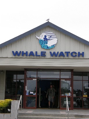 il going under, just missed that one. But weíre supposed to see more still: there are many in the area. One of those many is spotted by the captain. We hover the area and after five minutes he has spotted another one already. We can stay outside and sail to the whale. Again we see the spouting water and air from the surface. Even from such a distance itís a pretty sight. We record a few film shots, because moving images are better for these kind of things. Eef does that en Timo takes loads of pictures. We can stay a long time with this one and sometimes donít see any part of the whale because of the waves, but sometimes we see a large part above the surface. We take a lot of pictures again and Timo will have over 70 only this afternoon. Itís an amazing feeling that youíre that close to one of the largest mammals in the world. The sperm whale is 18 meters at its largest, which is twice the size of our catamaran. The boat is full.
By now time has almost run out: weíre out already more than half an hour and they announce that we should be heading back to the harbor. But the second boat of Whale Watch Kaikoura has seen another one and that is the last and best sighting. We watch this third one very long and now we donít take a lot of pictures anymore, but enjoy the moment. It is really magnificent and this is indeed one of the highlights of the vacation. We had high expectations, but it did not let us down. Really amazing, marvelous, magnificent, especially when you know what kind of animal this is. Again, the third and last time weíre being told when to hold the cameras ready and now Timo can capture a few different phases of the start of a dive of a sperm whale. First he bends his tail and then the tail comes and thatís what all people are waiting for. Three, two, one, a great experience and you can feel the tense emotions on the boat, when the moment arrives.
Then itís time to go back to the harbor. We receive some additional information and see footage of sperm whales and other whales and are back in fifteen minutes. The same bus brings us back and we walk back to the camping. We want to find and Internet cafť, but there is none, so we have a drink at the same bar as yesterday: The Whaler. Two pints and then walk back without e-mailing and making people jealous. First a shower and then itís time to eat. We can already use some food, because we had an early lunch today. We can look back at a very nice afternoon, despite the fact that Timo is not feeling well.
We write a couple of cards, not to everyone, but still want to send a couple of card home. We think weíll be home before the cards, but weíll see that. Later today weíll eat spaghetti and drink a good glass of wine and again go to be early. Eef cooks and Timo is just doing nothing. A manís gotta do what a manís gotta do. We have spaghetti with fresh vegetables and then s-quickly go to bed to dream about .... Whales!
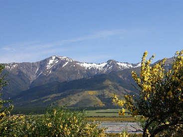 Day 19: Thursday November 18, 2010: From east to west, from Kaikoura to Greymouth, from the South Pacific Ocean to the Tasman Sea
The day starts very foggy. We canít see the mountains that made us so happy when we arrived here. The departure will be in a different atmosphere than the arrival here. The fog conceals the mountains from our view. The once so sweet village of Kaikoura with its sea and mountains has been changed to a grey and misty landscape, but it gave us happiness when we came here. We were filled with joy on arrival, by the seals, the mountains and yesterday we loved the sperm whales. When you spot such a huge animal, you feel very small, literally that is. Such an animal is 18 meters long. You can fit a lot of Timo and Eef in there. Our breakfast is as it was usually: coffee, cornflakes, bread, cheese and now also salami: from time to time you need to have a different flavor. Today we drive all the way from east to west, maybe to Westport, but could be we continue to Greymouth: weíll see what we like best and how long we can stay in the van. The total distance is more than 500 kilometers. In a camper and over the mountains itís not so easy, so you canít count five hours for this, but rather six or seven, or maybe even eight, but youíll read about that later.
Weíve seen everything here what we wanted to see, so we donít delay our departure. At 07:45 weíre already on the road with the camper and Eef is driving. First we follow HW 1 to Christchurch, but thatís only for a few miles, then we turn right to HW 70. This is the Alpine Pacific Triangle: a scenic route that brings you from Kaikoura to Christchurch and then back via Culverden and Hanmer Springs to Kaikoura; we only do a part of this route and drive the 88 kilometers to Waiau in about an hour. There we stop, buy leaves for the tobacco and move on. We donít loose any time here. From Waiau it goes to Culverden over Rotherham and then along the river Waiau. The main thing for today are the riverbeds that we 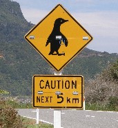 follow. The landscape we saw until now is nothing different to what weíve seen before. The green pastures offer grazing possibilities for the sheep, cows, horses and alpacas. In Hanmer Springs the landscape changes into dense forest that grow along the riverbed. In this area some forest parks are located, but we donít stop here for a walk. There are two hot springs here, but also for these we donít stop.
At the Lewis Pass (907 meters altitude) we see the Maruia River and drive through a completely different landscape as before. Weíre in a valley. That on itself is nothing special, but the special effect is caused by the broom that thrives here. The New Zealanders try to limit the growth of these bushes, because they consider the bush as weed. Itís provides a special effect with the yellow color everywhere. The light-blue river winds through the valley and provides the broom with water so it can flourish. The plant gives color to the mountains and the hills and covers everything with a yellow blanket. Beautiful, but it still is a weed. The slopes end in the summits of the mountains and they are covered in snow too. The weather since our departure, actually since we left Kaikoura, changed dramatically. The fog has gone and the day has turned sunny and it stays like that al the time. Weíre already driving for a long time and after three hours itís time for a break. We have that just beyond Springs Junction. Have a drink, short break to stretch our legs and then we leave again.
We have already covered 88 kilometers from Kaikoura to Waiau, then 22 and another 66 to Hanmer Springs and then the last 85 to the stop. Until now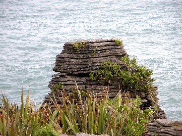 weíve covered already 221 kilometers. Eef hands over the wheel to Timo and he will complete the trip for today. Now we follow the river Inangahua, from Reefton to Inangahua, the village. You canít call the villages actually villages, because there are on average only five houses and in less than five minutes youíre through. The same applies to Reefton and Inangahua. That means weíre 79 kilometers closer to our destination. Just before Westport we decide to drive all the way to Greymouth and it makes the drive to the glacier shorter for tomorrow. It means a few hours more in the car today. The drive to Westport is along the River Buller. It has a wide bed, but the river is not very big now, although on some points itís wider and deeper than average. We notice that there are more wild flowers here: common foxglove in different colors: purple, blue, white and itís all very beautiful in the valley and the mountains of the Buller. On some place the road is very narrow and about six times the road becomes a one-lane road, because there is so limited space between the side of the mountains and the abyss. One time there are traffic lights to ensure that traffic is going smooth. We have the benefit of a splendid view on the river, the valley and the complete landscape in this area.
We had the plan to take HW 6 to Greymouth and to only stop at the Pancake Rocks and the Blowholes. Weíre driving already the whole day and need a break. Itís 12:45, so Timo is driving for about two hours. We look for a picnic spot beyond Westport, but canít find one. Weíre looking for twenty minutes already, but there is no designated area. So we stop at a wide part of the road. At the other side there already is another camper, also taking a break and we park there. We have lunch and stretch our legs. We still have 100 kilometers to Greymouth. The sun is shining and we enjoy the warmth. That is very nice. We thought this part would have gone faster as it is a coastal road. The last twenty minutes we passed a landscape covered with flax, no idea what kind this is, but it looks strange. After half an hour weíre ready to race on, although Eef already has enough. We persevere to get to Greymouth and first visit the Pancake Rocks.
Once weíre on track again, we see one spot for picnic after the other; itís always like that, but we just move on towards Punakaiki where the scenic reserve is. Timo parks the camper and weíre going to check the surroundings out. Mother Nature has caused a special effect. The rocks are located along the coast in the Paparoa National Park and they have the resemblance of a big pile of pancakes. The wind and waves have changed the rocks in bizarre shapes. At high tide you can see the blowholes that spout water from the holes in the rocks. Now itís low tide, so no blowholes in action. From the I-site there is a short walk of 20 minutes to th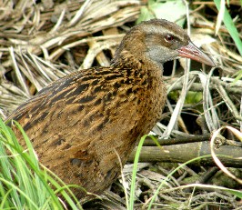 e most beautiful parts of these rocks and we follow the track. It was about time we would do something. All this is really worth a visit and weíre stunned by the special shapes. They actually look like piles of pancakes. Information signs show us that there are certain shapes visible in the rocks, like heads and animals, but for the most part you need a lot of phantasy to see them. The wind and water has work in progress. Maybe these kind of rocks will cease to exist in near future.
After this short visit we continue out last trip for today: from Punakaiki to Greymouth. It takes only one hour and weíre there. The road is pretty flat now and brings us to the city of Greymouth. When we enter the city we cross the grey River and see a Countdown, so we first stop for groceries. We buy something for today, tomorrow and the day after. We need to have some beer and wine: a person needs to drink huh. After the shopping we drive to Greymouth Seaside Top 10 Holiday Park. We find a spot (number 34) close to the sea at the end of the park and can start recovering from the trip. Eventually we have done 490 kilometers and on some maps they said we would do it in seven hours. Weíve done it with less, but it was long enough. We have also exceeded the 3000th kilometer. From our departure in Auckland we already did that distance. Itís not bad for two and a half weeks. We look at the pictures on the laptop and then we do the same as every other day. Timo wants to finish the travel report, Eef reads her book and then we can surf the wireless network of IAC (Internet Access Company), which is available on several Top 10 Holiday Parks. In Motueka the provider should have been also at other parks, but I fear we just lost the remaining time we had there. Maybe itís the same one later one, but weíll see.
We of course first take a shower and then we eat. Today we have chicken, tomato, salad, Mexican rice and a glass of wine. The preparation is short and we enjoy it: the flavor is different and thatís nice. In the kitchen there is a guy with his daughter. The child is about 10 Ė 12 years old and they ride New Zealand by tandem and with a tent. That is challenging. We talk to them and then go back to the camper and go to bed early. Itís only 21:45, but weíre exhausted and need to have some rest and need to get up early tomorrow.
Day 20: Friday November 19, 2010: Franz Josef Glacier
Time fl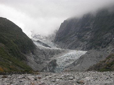 ies, weíre already day 20 today. The planning started only on day 2 when we actually arrived in New Zealand, but for the reports I took another count, the day of departure was day 1. On the North Island we were able to follow the planning very well and arrived on time at almost every location. We did not dive on the South Island in Blenheim, so we are one day ahead of schedule. Hopefully we can keep it. The difference between now when I write the report and this morning is huge. This morning we get up with high clouds everywhere, but here in Franz Josef itís raining now and it has been raining whole day. But letís start at Greymouth this morning. Suddenly Timo is thinking that the reason for the name if probably because the city is located at the mouth of the Grey River in the Tasman Sea.
We leave after breakfast and we have something else: bread and strawberries in the morning sun and thatís always a winner. We have time today. The transfer to Franz Josef should not take that long. Itís only 200 kilometer from here, so we need to do that in about two hours. Eef starts the trip behind the wheel and then sky is blue and white with little clouds. The HW 6 is constructed in a flat landscape and is called the Glacier Highway. How is that possible? The ride goes fast and from Greymouth we head towards Hokitika and fill up the camper there. Since the last time we want to have some more reserve if we have to drive a long distance. It not really necessary now, but we donít want to take any risks.
Then onwards on the HW 6 to Ross and Hari Hari. Tourism Radio gives information on what is worth a visit in the area and they want to direct us to Shantytown: an old town from the mining and gold rush ages, but we donít want to. Really not, even 50 kilometers from Greymouth they want to send us there. NOOOOOOOOOOOOO! We race to Franz Josef, because we have a reservation there tomorrow with a helicopter. On the way there we already think that it will not happen: the weather is not getting any better. During the last couple of stops the sun s there, but the clouds in the Southern Alps are getting thicker, greyer and darker and they are lower all the time. Thatís right. When we arrive the clouds are at their lowest level and it starts to rain slightly.
The trip here was very beautiful. The mountain rivers are coming down with lots of noise. We were driving on a plane and left, sometimes right in front of us, we saw the summits of the Alps in the clouds. The mountain range is just like in Europe called the Alps. We donít see the peaks, because the clouds are low as already mentioned. At 11:30 we arrive in Franz Josef and walk around in the village. The ĎNew Zealand Helicopter Scenic Flights Ė The Helicopter Lineí, with who we booked the flight for tomorrow has an office here, so we first are going to check, how everything is going tomorrow. And if possible we can reschedule to today. We arrive there, Timo explains what he wants and he gets little or no information from the unkind lady at the counter. This is one of the rare occasions when they act unkind, but this will then be the exception. The girl was totally not friendly, did not give additional explanations or information. She was just sitting there and being unfriendly. Probably this was a bad timing. It comes down to the fact that nobody has booked for tomorrow and they donít fly for two people, at least there need to be three. Also for today nobody has requested a booking and it rains and the weather is bad, so nobody will come. In short: tomorrow we need to go to Fox Glacier and then weíll know if they fly. That means that we donít have anything to do the rest of the day.
Timo quickly decides to the desk next to this one to a person who is friendly, like most New Zealanders and she tries to help if we still can do something. At 12:30 there is a departure for the trip ĎHalf Day Glacier Experienceí to the glacier and we quickly decide to participate. Jeans are not allowed, they advise to wear multiple layers of clothing on the glacier, so we need to go back to the camper, wear more clothes and then find something to eat. The cities in New Zealand have many take-aways, but when you need one you canít find any. We then have toasted bread with ham, cheese and tomato. We eat it on a bench at the other side of the road, outside, and itís not raining for the moment. Weíll drink some water on the glacier later on. That was assuming we would get there fast, but thatís not the case.
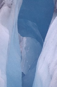 The first part of the glacier experience it the check-in, fill out a form where you refrain from any responsibility of the agency and take everything on yourself. And then the worst part comes: everybody, about fifty people, need to receive and wear special rain trousers, then everybody needs to try on mountain boots and socks, and then take the crampons from the third desk and yet another desk provides gloves and a raincoat. The explanation is fast, but it takes over an hour. For one person the boots are a size too large for the other one too small. Timo is annoyed by that, but that will get better Ė at least I hope so. An hour after check-in we can go on the bus for a ten-minute drive to the glacier. There we get off with a small backpack with some food and drinks and start walking the path to the glacier. We need to walk 2.1 kilometer to the mouth of the glacier, although it does not seem far at all. It more looks like half the distance, but that is an illusion. It takes us half an hour before we arrive there. We see beautiful waterfalls that come from the peak all the way down. There is one very large en very beautiful one in the valley.
At the beginning of the moraine we need to cross a large pile of debris that the glacier has left here in the last years. The moraine consists of sand, boulders, rocks, and other material that was brought here. The climb is steep and is over a zigzag path. We were already divided into four groups and weíre in group number three: we will stop more often to take pictures and stuff, so weíre OK with that. In the end we reach the ice after two hours and are wearing the crampons already. At first sight this is a bit of a disappointment, because the glacier is not white, but white with a brown layer on top. Itís all sand and rocks on top. The most remarkable thing about this glacier is that it formed on a low altitude. In the nťvť in the mountains yearly an amount of 35 meters of snow falls and that needs to go somewhere. Because these mountains are so high, there is a lot of snow, so the glaciers here can exist thanks to these circumstances.
With the iron crampons attached to our boots we walk over the glacier. The view becomes better. Many small glacier-ice-water comes flowing down and the parts not covered in sand and rocks are nice white and the ice sometimes has a blue shine to it. The glacier is beautiful on many places. The weather is not so good, because itís raining like hell; luckily we have a good protection. We walk comfortably over stairs cut in the ice to the top for about an hour. It is almost a normal walk, but one with a beautiful view. The higher we walk the more beautiful the view on the white and blue of the glacier becomes. If youíre having fun an hour passes quickly and soon we reach the top of the walk. We stop in the raw wind that blows here. Nobody understands why they stop here at the coldest area. Two keas make us forget the cold. They come flying towards us and check if we have something to eat. Pictures need to be t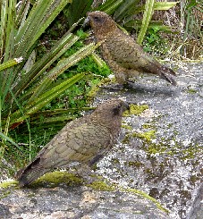 aken of course of the kea, the only species of parrot that lives on the snow. These animals really can be a pain for tourists, because theyíre smart animals. Stories are known that they plunder the bags of the tourists and eat everything thatís edible. According to the guide they have the brain of a four-year old or a 23-year old Aussie: thereís always some rivalry between Aussie and Kiwis.
After a break of fifteen minutes in the cold we start the descent and the walk back to the parking lot. Apart from rain there is now also wind, which blows heavily over the ice. The area is magnificent, but very cold, itís difficult to imagine how cold Ė and itís Timo writing this, so it must be cold. If you know me, you also know Iím never cold, but here itís very, very cold. Weíre group number three and we wait until group 1 and 2 are on their way back and then we can also descend. We start from the other side of the glacier, cross it and then reach the moraine again with itís brown and grey waste and sometimes the blue and white can come through, but over all it really is nice to climb a glacier.
The way back is fast and then itís again the 2-kilometer walk back to the bus. The last part we get out of the riverbed and use a path through native forest only for guided walks and then itís not far anymore to the bus. On the parking lot there is a couple of keas and they think they can find something to eat out here. When we reach the bus we leave for the 10-kilometer drive back to the office of the tour. We hand everything back in and get a card back. Now it seems to be a lot better than when we started. The groups were divided over two buses and everybody knows now what needs to be done. After our arrival we have a beer and then drive to the Top 10. The weather is still not OK, because itís raining and cold. There is a site available on the camping and drive to site 132. We need to get used to this new spot again and then cook, eat and go to bed. Weíll check tomorrow for the helicopter flight. If it gets cancelled we can continue early to the south and keep the day weíre ahead of schedule.
Day 21: Saturday November 20, 2010: Theme of the day: water in many different appearances
The first appearance we see is water in liquid form: rain. We get up in the morning and itís raining. It has been raining since yesterday evening and has not stopped during the n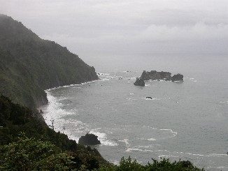 ight. The campsites are flooded. Yesterday we could still smoke a cigarette in a dry area, but now the whole area is flooded. Timo doesnít mind, because he remembers Costa Rica and that was worse. Itís raining and makes you wet. The way t the kitchen is not far, but weíre soaked when we get there. It was an idea to have breakfast at the camper, so we donít do that and eat in the kitchen. In general the Top 10ís are well equipped with everything you need to cook and wash up, so we have all we need. We eat our breakfast and donít want to stay here very long, because the weather is really very bad. We donít even see the mountains that are only one kilometer away from us. Weíre happy we visited the glacier yesterday, because today is not as good as yesterday, Iíd could say even it looks bad.
After our breakfast we drive from Franz Josef to Fox Glacier. Here we normally have a helicopter flight over the glaciers and Mount Cook with a snow landing, but yesterday already we feared that it would not happen today. In Fox Glacier we soon find the office and we can move on, because the guy at the desk says there wonít be any flights today. There is no problem with the payment, because they only had the credit card details to be sure of payment. If someone does not show up or something else. So we have the whole day we can choose what to do. At least if the weather gets better. We think the best thing to do would be to drive as fast as possible, so we keep in front of our schedule. We donít want to have lack of time at the east coast, because that would be a shame.
From Fox Glacier we drive to the south, in the direction of Haast. During this part we cross a lot of small bridges. Most of the bridges here in New Zealand are one-lane bridges. A few meters before the crossing ĎONE LANE BRIDGEí is painted on the road and on the side there is a sign that reveals which side has priority. Itís a small adaptation; especially we need to adapt the speed. It can be busy at a point like that but we did not encounter that often. The roads are not busy at all; you can have a high average speed because the traffic is low most of the time. The busiest track was around Auckland and that was about it. Apart from that you see a small number of cars, only tourists in th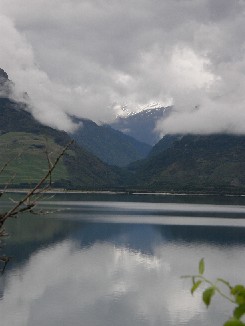 eir campers and that it. We race through New Zealand; I mean drive, because the weather does not permit us to race. We take our time, especially in the curves and drive south. The first short stop is Bruce Bay. We are at the coats (water again) and Tourism Radio tells us we should be aware for debris on the road when itís high tide. The water can be so high that trash is left on the beach and the road.
Until now the road was OK, no works, not yesterday and not the day before, so weíre glad that everything is going well. We pass Lake Paringa and Lake Moeraki, water again and it still is raining, so weíve seen plenty of water already this morning. The lakes are small, but when we drive past them we like the views. We can imagine that a picnic would be nice when the weather is better or it would be lunchtime. We follow the coast no longer and then see the ocean again at Knights Point. At this point of view itís busy, but itís nice, even with the fog. Side-info: Timo is driving with the lights on, itís that bad today. After this stop we drive to Haast along the ocean all the time, but we drive slowly. In Haast there is nothing we really want to see, except the longest one lane bridge in New Zealand and we need to cross it. It a bit exciting, because it is very long and luckily there are no oncoming cars.
From Haast the first part of the road is flat and then heads for the mountains: all the time next to the river Haast. We stop to see some beautiful waterfalls: Thunder Creek Falls. They are very high, particularly when you go down to the river and look at them there. It has rained all night and the rivers and falls are swollen and more impressive than during dry periods. The road is nice and we move without any stops to Makarora, but there is plenty of rain and waterfalls. Even at the side of the roads sometimes falls are formed. Just after the Haast Pass, which is nothing, because we did not notice the pass, the River Makarora ends in Lake Wanaka. We follow the lake at our right side and think we should stop several times to enjoy the view. The lake is yet another appearance of water. The good thing now is that the rain has stopped and the views are a lot better now. We drive along the water of the lake and then cross a hill. Then we see that on the other side there is another lake: Lake Hawea. We were driving between two lakes, but can only see one at a time. The high h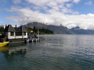 ill is blocking the view. The beautiful landmarks are the lakes and the water is flat, because the wind has dropped. We see marvelous reflections of the mountains in the water and even the clouds and fog surrounding them are great. We love the beautiful landscape all the way. That is something you can say: New Zealand has splendid landscapes.
In the town of Hawea we no longer see the lake and drive to Wanaka, a town with the same name as another lake or is it the other way around. Then the road goes to Albertown and then to Wanaka and when we reach Wanaka we need a break. For the locals the normal life is moving on. Itís Saturday and many shop, others skate and people also play cricket. We are not interested in their day-to-day business and have a small lunch on a parking lot at 13:20. A small snack, bread with canned salmon or tuna, but it tastes good. All right. Whatís next? Do we continue to Queenstown or stay here. We quickly decide and drive further to Quown (abbreviation of Queenstown). Another 70 kilometers and we need to be there. On the map there is a yellow and a red road, the first one is 70k, the second one 120. We immediately know which one to take.
At 14:00 we leave Wanaka and take the yellow road to Quown. The environment seems rather strange: we descend Ė at least thatís the impression we have Ė and yet the river next to the road is running into the direction weíre coming from. This would mean that the water runs uphill, which would be a remarkable phenomenon, even on the other side of the world. We think our eyes are fooling us. Then the road is steep uphill until we reach a beautiful point of view over Queenstown. According to Tourism Radio that is, because they did not take the bad weather into account. Of course not. This is just GPS, no weather forecast. We donít see a thing, except that it now goes steep downhill: the clouds and fog limit the visibility to just a few meters. It has started to rain again; you could say storm and that made the climb dangerous. Just like the descent. There are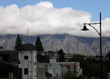 many hairpin turns and with a camper of 7.10 meters we need to be very careful.
We reach Queenstown without any problems and first look for a supermarket and then for the camping. Good. The supermarket we find that quickly and buy some food and than search the local Top 10. Weíre used to these parks and have the discount card, so we prefer that. After the stop at the supermarket Eef reads the map in the Lonely Planet Guide, first drive away from the camping and then back to it. This is surprising. The supermarket is located 20 meters from the campsite. We did not notice we were so close already. We arrange a site (powered one for two people) and then have a beer and discuss the planning for tomorrow. Weíll go to Milford Sound tomorrow and will book it later on. Then we can go to Dunedin in one trip and then have a few mores tops at the east coats and then to Christchurch. That should be possible. And we can of course still change the planning later on.
Then we have some time to explore the center. There itís very busy: a rally contest just finished: the Silver Fern Rally. In the center all the racecars are parked and it looks nice, but itís too busy to stay here and we have a drink in a bar. Two beers and we need to stay protected against the wind to stay warm and then return to the campsite, have a shower and something to eat. Eef has the pizza that had to be eaten today and Timo prepares spaghetti bolognaise. He would be able to eat that every day almost. A British couple is also cooking and start chatting. A bit after eight we go back, have a drink and write the report and go to sleep.
We did reserve the trip to Milford Sound for tomorrow and we need to be ready at the reception at 07:50, so we should not stay up too late. Tomorrow prepare lunch, have breakfast and get ready for departure. We might need to rush, but I donít think so. I canít imagine we would be in a hurry during a vacation.
Day 22: Sunday November 21, 2010: Milford Sound: probably thť highlight of the vacation
Milford Sound: for many tourists and New Zealanders this is the number one place to visit in the country. So we canít skip that. It will be a long day with a bus trip of four 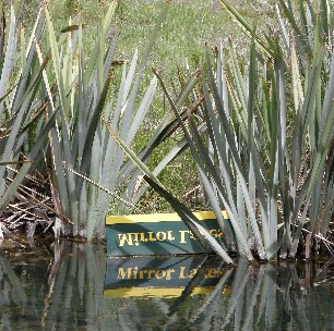 hours, then two hours on the water and then another four hours back. Weíll probably only return at about eight. The pickup is at 07:50, which is OK, but still need to rush a bit before we leave. We got up at 07:00, had breakfast, feed the ducks and then walk to the pickup place at the entrance of the camping. We take the laptop, because they told us there was WIFI on the bus. Weíll see about that.
At 07:50 sharp weíre waiting outside the camping and a large bus of Kiwi Discovery arrives empty. We get in together with four adults and four younger girls (about 17). Then we do the usual pickup stops for the other people, but there are not so many stops: most of the people get up at the office of Kiwi Discovery. Half an hour later we leave Queenstown. We receive a short introduction of the driver, Kevin, and he explains how the rest of the day will be. No worries, weíll see that later on. The first part is along Lake Wakatipu. The mountains on the banks ensure the views are again great, marvelous. Once we left the lake we try the WIFI, because we donít need to see the farming lands of the south of New Zealand. Thatís not our quote, but the one from Kevin. We surf the Internet: yep itís actually working. We send some e-mails and make everybody jealous again. Thatís not really difficult when youíre in New Zealand.
We drive without stopping to Te Anau. There is the first stop after a drive of two hours. The driver steps on it, so everything is according to plan. We rest a bit, have a coffee, take some pictures of Lake Te Anau and after half an hour we leave to Milford Sound, the end of our trip. From now on the driver stops from time to time at some places that are worth stopping for to take pictures. The first break along the Highway Te Anau Ė Milford Sound is Earl Mountains and the plain that has been formed by the River Englinton. The river has carved out a large plain over a long period of time. Itís beautiful as you can see the grassy plain and in the background the mountains. Five minutes onwards we have our next stop: Mirror Lakes. If the water is calm you can clearly see the reflection Ė thatís where the name comes from Ė of the mountains in the water. The color on some places is marvelous and they have put down a sign upside down to illustrate they are real Mirror Lakes. There is a short track of ten minutes along the road and the lake. The driver drops us off at one end and then picks us up again at the end of the track: itís very easy and worth a stop. The road is straight and the bus can ride st ill fast. The last stop before we reach Homer Tunnel is Knobs Flat. Again we see a plain and the snowy mountains in the background, a great view. The people can make a last stop here. Later on there is only beech forest that can serve as a toilet.
We get the change to take pictures a few more times and that is just after The Divide. We stop here to pick up a couple of people to who finished their hiking or tramping and want to see Milford too today. The sound is not actually a sound, but a fiord. The difference is that a sound has been formed by flooded riverbeds and a fiord has been carved out by a glacier. Lake Gunns also provides stunning views, but we donít stop here, rather in a plain before we climb up to the Homer Tunnel. This tunnel connects two plains via a road that is one of the most impressive sceneries of the South Island. We climb very quickly, stop one minute for a picture of falls, but donít stop and then itís only uphill between great mountainous landscapes.
We need to wait a few minutes at the Homer Tunnel, because traffic is arranged with traffic lights. Every fifteen minutes the lights change, so we have a few moments to stop. Like the last break we see keas again. On the previous stop there were two, now about seven. They are magnificent animals with blue at the top of their wings and red at the bottom and side of their body. The rest is green. The driver needs to Ďhorní everybody back to the bus as they are stupidly posing against the mountains. The light turns green, so we need to leave, otherwise we need to wait for another fifteen minutes. Everybody is looking at the keas and it takes two horns before everybody is back. Just before the tunnel the green hills with beech forest have changed to black granite rocks and waterfalls are flowing down from all sides. Then we add the contrast of the white peaks and unmelted spots and that makes the area unbelievably beautiful. When we passed the tunnel the only thing left is a steep road with many curves and weíve almost reached the end now.
T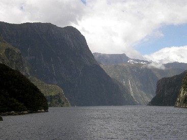 he whole journey from Te Anau to Milford Kevin has provided information about what we saw and about the history. The thing that is present all the time is the criticism on the Europeans that they brought animals, plants, trees to New Zealand that have grown to a plague. Kevin speaks about rabbits, deer, pigs, weasels, rats and other mammals. Also he talks about the broom and the purple, lila, yellow and white flowers at the side of the road. Then the time for some action has arrived.
We arrive at 13:30 in Milford Sound and are immediately impressed by the views. First we need to take a difficult decision. Will we return with the bus or with a scenic flight? Thatís a tough one, because the price is high. I wonít mention the price here. We quickly decide to get back with the flight, if the weather permits. Weíll be back in forty minutes instead of four hours, but we think we should do it, especially after the flight at Fox Glacier was cancelled. Thatís done. Now we board the Milford Monarch, the boat that will tour us on the dark water of the sound. Timo needs to be an exception and goes out to take some pictures already and misses the first boarding. No problems and no worries, because he has a boarding pass.
He arrives almost as last person on the boat and enjoys the view already constantly. You see the mountains rising from the sea for meters and meters. The first landmark that strikes is Mitre Peak, really spectacular, very photogenic with its height of 1692 meters, directly from sea level to almost 1700 meters, unbelievable. We have our lunch on board, drink a coffee and are ready to leave for about one hour and 45 minutes between this impressive scenery. Striking also is the height of the mountains surrounding the fiord. Itís not a small hill, because if you sail in it and you see the other boats against the rocks, they only look like a mouse. Itís very impressive, really amazing. Also available here are many falls. They start all the way at the top and seek their way down from left to right to end at sea level. You see the path they use from 1500 meter to the bottom. The clouds are hanging over the peaks, but the weather is getter better every minute Ė ideal for the flight later today Ė and the clouds are sometimes disappearing too. This is lovely. We ride the whole fiord until the end where the mouth is in the Tasman Sea. Just before that point the boat stops for the sighting of some special animals. On the rocks two couples of penguins have their habitat and one single. This species of penguin is only the size to you knee, about half a meter, unless youíre a hobbit. They have a white front and black back, r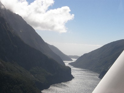 ed feet and beak. They have a yellow eyebrow stripe from the beak to behind their ear. Theyíre beautiful animals and also the first wild penguins we spot. The species is called the Fiordland Crested Penguin
Then we reach the Tasman Sea and the boat turn to the other side. At this side it is as impressive as on the left side, what did you expect. We feel very small, very small. Suddenly from sea level a mountains reach steep upwards to the sky, almost a wall into the blue sky. Yes, indeed the sun is shining with few clouds. If we can fly back or not, this is fantastic. Now you can look from one side to the other side and see the large vessels in between, thatís amazing. The vessels are big, but if you compare this to the mountains this is just a small dot at the horizon. The slopes are covered with native bush, when theyíre not to steep. If they are, then there are ferns and exceptionally a lonely tree. We stop at Seal Rock and the reason for the name is clear, because there are seals on the rock and one is swimming in the water alone. Then the captain heads for a waterfall and sails right trough so all people get wet. Timo does not want to take any chances and goes inside with the laptop and the camera in his bag. Water can be fatal for electronics.
Then the boats stops for another seal colony and then a stop at a rock that is very very steep. The boat lies almost against the side, so that means the under water it is as steep down ad it goes up. It is straight up, about 1500 meters: that is unbelievable. The journey comes to an end; it went really quick. At the start of the trip there was a lot of wind and there were many clouds, but now itís much better, less wind, more sun and it looks very good. The remarkable here is again the contrast. I know Iím repeating myself, but itís like that. The dark 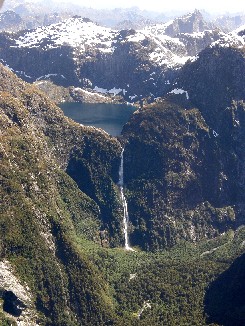 water, the green, sometimes black (if nothing is growing) hills and then the peaks of the mountains with the snow. It is worth visiting this and watching at everything all the time. I canít imagine anything that is prettier.
After almost two hours the trip is over and we return to the harbor. There we need to get on the bus. The bus will bring us to the airport of Milford. We are introduced to the pilot (Ray donítknowhislastname) and we get a small lifejacket and can leave immediately. Thereís no fuzz with check-in and stuff. Only get on the plane and leave. In total there are six passengers and one pilot. The rotor starts to turn and we drive on the runway and then we get airborne. Yes, great, marvelous, magnificent. The pilot first makes a turn over Milford Sound; itís nice to see it from land first, then from the boat and now from the air. Breath-taking. I canít describe this in a different manner. We get up to an altitude just over the peaks and enjoy, enjoy and enjoy. We first fly over the sound, then over the mountain and over Humboldt Falls. These waterfalls are gorgeous from the sky. You can clearly see a big lake up in the mountains, beautifully blue and that is the source of the magnificent waterfalls. Theyíre very high and the view is greaeaeaeaeaeaeaeat.
We love the views a lot, it seems if the mountains and the snowy peaks donít end, that they continue to the end of the world. We fly over the valley of the Erlington River where we also stopped this morning and then arrive at Lake Te Anau. At lunchtime we saw the lake from the ground, now from the sky. The time goes very fast, because soon we reach Lake Wakatipu and see a rainbow over the lake. The pilot briefs us what we see outside, otherwise we would never know. Lake Wakatipu. Damn, thatís almost the end then. The rainbow over the blue water of the lake is magnificent and in the distance we see Queenstown already. We see the bay and get a bit sad itís already over. The forty minutes of the flight were over very quickly. We make another tour around the lake head and Queenstown to reach the airport. After the landing we follow the pilot and arrange payment. Luckily they also accept plastic money, if not that would have been a problem.
THIS IS AN EXPERIENCE THAT WEíLL NEVER, BUT REALLY NEVER WILL FORGET! ITS UNBELIEVABLE, BUT WE DID IT, UNBELIEVABLY AMAZING!
Then they bring us back to the center with a taxi, free of charge, we have a beer and are very happy to have lived a day like today. We watch the pictures and the films, Timo writes the report, then we eat and then we do nothing anymore. We dream about the scenic flight of today, of the sound we saw today and all of the other impression we already have of this vacation. Time here is shortening, but if we can close the vacation in this beauty weíre happy. The last days have indeed been great. High mountains, waterfalls, valleys and rivers from the ground from the water and from the sky. A splendid day. This could become number one.
Day 23: Monday November 22, 2010: Transfer to and exploration of Dunedin
The report of yesterday was very long; the one of today will be shorter. There were many things to tell yesterday and we experienced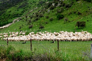 more on one day than during the whole trip. In short: we left Queenstown in the morning, drove to Dunedin and explored the city. Thatís it for today.
Or no, I will tell a bit more about day 23.
This morning when we get up, itís almost freezing: thatís how it feels. Itís only ten degrees and when we leave only 9.5, so you canít call this a warm morning. During the night it was ice-cold, even Timo felt cold. And you need to travel to the other side of the world for that. We changed again the planning and decided not to go to Mount Cook, but stay one day more in Dunedin. In Dunedin there is the Otago Peninsula and you can see the albatross there and the yellow-eyed-penguin, so we want to stay there longer than just one afternoon. We have breakfast in the kitchen, because the camper is standing in the shade, but then youíre out of the wind, behind glass and in the sun, so that is much more pleasant. We finish breakfast, then do the dishes and want to leave immediately. Itís almost nine, so weíre on the move late today.
Our first task is to get out of town. That goes well, although we need to turn several times and then we decide to follow Frankton, but we donít need to go there. We reach the 6a and are then on the correct highway later on. The sign directs us to Cromwell and thatís the direction we need to be. We need to pass the airport and then perfectly find our route to Cromwell via HW 6. We first fill up and then we can leave without any worries. At 09:30 weíre on the correct highway. The landscape is flat and also very dry. This is one of the warmest and driest areas on the South Island and they grow a lot of grapes. Tourism R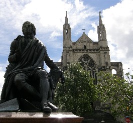 adio wants us to have a taste and enter the wine cellars, but itís too early to drink. After 45 minutes we reach Cromwell and from there Tourism Radio wants us to do panning. We donít want to search for gold with a pan. Almost every village here is established before, just after or during the gold rush. We had enough of the gold rush stories, just like Shantytown ď10K South of GreymouthĒ (and even a saloon), so we drive on. We follow the River Kawarau that has carved its bed out of the huge rocks. In this area, actually rather in Cromwell there is the bungee jump of all jumps. The famous AJ Hackett Bungee who were the first to jump. We pass the bridge, but donít see anybody jumping.
The road slowly continues through small villages and cities: Clyde, established during the Gold rush, Alexandra, also est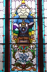 ablished during the gold rush and there we continue on HW 8 to the south. We saw a couple of rivers and a few lakes: Lake Dunstan, close to Cromwell, Lake Roxburgh, close to Roxburgh. The drive is beautiful, but there is nothing special to see. Actually you get spoilt here, itís a disgrace. The green hills are covered with white dots and every dot is a sheep. In that kind of scenery we continue. Before we drove through a dry landscape with rocks, large stones, brown hills without any vegetation, but that is nice too. The next kilometers from Milton to Lawrence, where we stop for five minutes are always the same: generally flat, with a hill now and then and all with white dots on the slopes. Weíve seen this landscape for hundreds of kilometers already, so we drive and drive. In Milton we need to get back to the north for Dunedin and we cover that in one trip to the final destination of the day.
The final part is really highway with three lanes in every direction, you can ask yourself who is using these: for one thing weíre using one of them. In Waihola we drive past a lake, but there is nothing else to see. When we arrive in Dunedin we look for the center and try to find a parking space. With a camper of 7.1 meters thatís not easy, but weíre lucky. We need to pay 1 NZD per hour and that is not so expensive. We park the camper, we plan what we need to do and then walk to the city center. Less than ten minutes later we arrive at the O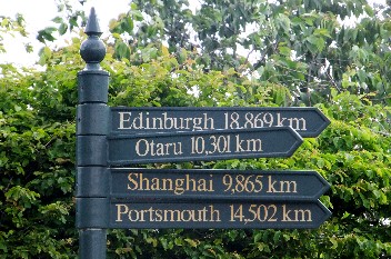 ctagon, the buzzing center of Dunedin. It is a roundabout and eight streets come together here, itís very cozy. First we check at the I-site where the camping is (we get a free map) and we ask whether we can see albatrosses and penguin without booking upfront. We can try, but weíll see about that tomorrow then.
After we got all the information we have a snack at Di Lusso, a Mediterranean salad and also fritattas. Itís nice, just tapas, so not that much. We enjoy the sun that has appeared: itís pretty chilly today, but not in the sun. We go to St Paulís Cathedral and to the railway station. The station is very pretty and unique with authentic ticket counter and beautiful glass windows and the total architecture is beautiful. Especially the view from the platform that measures one kilometer is really special. We have seen a bit of culture now and then itís again time for the usual stuff. We buy food at a Countdown for today and tomorrow and then itís time to go to the camping. Eef has improved her navigation skills and we immediately find the holiday park. We find a spot, steal a bench from another site and then surf the Internet and have a swim. The pool is heated and thatís very nice with these temperatures. Then we take a shower and then itís time to eat. Eef mainly prepares the food alone today, because she feels like cooking: ratatouille of her own interpretation. It will be good.
Eef prepares a very good meal. It has an Indian touch, something like a curry, but then with her own ingredients: tomato, carrot, onion, chicken, courgette and a bag of curry to add to that. Timo cooks the pasta, so he also did something and then everything is ready. We thought we would have leftovers for tomorrow, but we eat it all: itís so good. After dinner we keep ourselves busy with the laptop and a book and get really tired at nine thirty. The drives every day and then impressions we have: all that is tiring.
Day 24: Tuesday November 23, 2010: The Birds: Close Encounters
Today we have the intention to go from the Aaron Lodge Top 10 Holiday Park to the Otago Peninsula, visit some attractions there and then return. Most of  the tourist guides advise to spend a full day on the peninsula. We want to do that: the highlight here is the wildlife that lives in this area. We get up, have breakfast, almost forget to disconnect the cable of the electricity, but think about it on time. It would have been a problem otherwise. Luckily we did not yet experience that (knock on wood). This Top 10 has the same quality as the other holiday parks of this type where weíve been. The Top 10 is generally is a bit more expensive than average, but the quality if higher too. This holiday park seems less than the TOP 10 average, but is still quite OK. Weíve also noticed that on the South Island the holiday parks are more expensive than on the North. Now we pay in general more than 40 NZD for one night and on the North Island it was almost always less than 40.
Eef finds her way out of the city under the professional guidance of Timo and then the right away to the Otago Peninsula. That is a nice, curvy, narrow road all the way to the end of the peninsula. We drive all the way to the end to the Royal Albatross Centre. The road follows a few very beautiful bays and we see for example Mac Andrew Bay and Broad Bay. In an hour we reach the centre, but itís not yet open today. As of tomorrow you can do a tour to the observatory and then you can see the nests of the albatrosses from very close. We reserve a place on the tour tomorrow at 09:30. If weíve spotted enough albatrosses by then, we maybe donít do it, but we donít need to pay anything in advance, so no worries.
At the centre we see two albatrosses flying. The pairs take turns to breed. At this moment the eggs are laid and they are being watched by the male and the female. From the ground this is a great sight, how majestically these birds fly and we think itís very nice we can see this. Tomorrow weíll see more, hopefully. We then go to another bird encounter here on the island and that are yellow-eyed penguins. This is one of the most threatened species, but there is a farm where you can see them ve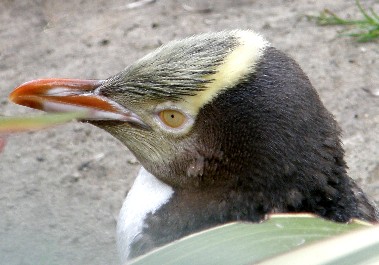 ry close. The farmers have installed nest boxes and the penguins use them frequently. That place is the Yellow Eyed Penguin Reserve. Primarily this is a farm, but they have changed their way of living so they can live together with these penguins that are on the verge of extinctions.
Weíre just on time to follow the previous tour that has just started. We can skip the introduction and pick that up later one. Itís a group of only ten people and we first go to the cages where the injured penguins and young penguins are rehabilitated. Theyíre just feeding one of the chicks. The animals are very pretty. I already gave a similar description during the trip to Milford Sound. We see that at this moment there are four chicks and one adult. Then we drive with a small bus to the beach where we can watch the animals closely. Once weíve gone off the bus we need to be silent, because these animals are disturbed by the noise. We through a passage under ground and the top is covered in nets and then we reach the first nesting place. It is marvelous: you can see the birds from about ten meters of distance, but there is no chick here. Then we walk to the second nesting place and you can see the animals even closer there (five meters). The female here has two chicks. That is impressive. The beautiful grown-up with two fluffy balls and that are the chicks.
We get to see a third nest, but itís not easy to get everything on the camera. Under the triangular nest boxes itís rather dark. You do see that the animals are feeling fine. Then we walk to another part of the colony and there are blue penguins. For this species they have also foreseen boxes, although they are more common than the yellow eyed. Normally they are in holes, but also here theyíve installed nest boxes and a lot of them are taken. You see the blue heads through the entry hole. The tour is guided, so we receive more information on their behavior and stuff, but I wonít bore you with that. Suddenly the guide yells: on the beach one penguin is returning from the sea. Itís very funny to see such a small creature wobbling over the beach to the bush where the nests are. Normally they stop on their way 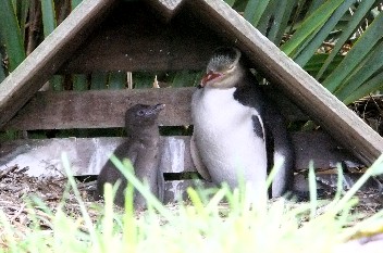 back, but this one is fit so he covers the beach from the sea to the high grass in one time only.
The tour ends and it only seems half an hour, but no, we were there for one hour. And it was a small group, which is nice. The good part of this tour is that a part of the entrance fee is spent for the care of wounded and sick animals on the farm. We support a good cause with this and you see immediately where the money goes. Nice. Then we have a dilemma: we take a walk or weíll do a tour with Monarch Wildlife Cruises. We quickly decide and then weíll win three hours and donít go to the Albatross Centre and can leave directly from the campsite. The price is one Dollar higher than the centre, so we decide to take the tour. Timo reserves a spot on the boat of 14:00, so we have two hours before departure.
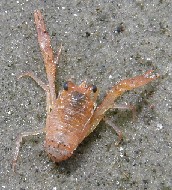 We continue our drive for a few kilometers and enjoy the beautiful view. We are at the seaside and look over the green hills at the other side of the bay. On the beach there are a couple of thousand gulls (2 species), oystercatchers, herons and a kind of wader, so this is ideal for Timoís bird watching-mania. Then we move to a parking spot for the camper during the boat ride and Timo walks over the beach. The whole beach is pink from the small lobster-like things and thatís also why there are that many gulls. We see living ones and put them back in a pool. This is plankton of which the whales are so fond and also the gulls apparently. Time flies and it soon is quarter to two and we need to walk to Otakau Bay, Wellers Rock where the boat, the Monarch will guide us through the reserve. We can board soon and just five minutes after that we see an albatross returning from the sea. He returns to his nest and uses the wind and therefore you almost donít see his wings clap. He will fly over the island and then returns to the nest on foot to take his turn on the nest. It is an impressive sight. A bird with a wingspan of three meters: that is really marvelous.
We sail to the island and make a stop for more birds: Timo is happy. We see the variable Oystercatcher, the pied oystercatcher, the royal spoonbill, the red-billed gull, the black backed gull, the white-faced heron. Three species of shags have also chosen this part of the island to build their nests: the Stewart Island shag, the spotted shag and the little shag. It is paradise for bird lovers. Timo spots two seals that are chasing each other, they are very playful and jump over the water. Itís a great sight! Then we go further and see more seals and also a gull-colony. And then the moment of the day comes. We sail out to sea, but donít see anything, so the boat turns back. The idea was to see an albatross sitting on the surface, but we donít have that luck. On our way back however the skipper gives full throttle to stay in front of the animal. From left the albatross hovers to the right and back: he uses the air perfectly that brings him up. He can do that for hours and itís really beautiful to see. And then suddenly the albatross flies five meters in front of us, just in front of the boat, it is stunning and then we realize itís a huge animal. He goes back out to sea and then returns another time to the boat and makes another passing. Itís unbelievable how beautiful and graceful this bird is. Everybody screams oohís and aahís when the bird with a wingspan of three meters passes by. Then he lands on the top of the peninsula and returns to his nest.
It is a special experience to see this animal like this. This morning penguins, now albatrosses so close, what does a person want more on a vacation. Quickly weíre now back to the wharf and we only know then weíve been away for an hour. Time flies when youíre having fun. When weíre back we see beautiful anemones living here in the shallow waters. That is also very nice, but is less impressive now after the close encounter with the albatross. We return to the camper and then drive the same way back to the camping. We had a day with a lot of excitement and now read a bit and write the travel report. This is not possible without a drink, so we buy beer at the supermarket and then everything is OK. Itís not really warm, but weíve had plenty of sunny moments today, which is nice.
Day 25: Wednesday November 24, 2010: Moeraki Boulders and transfer to Timaru
Th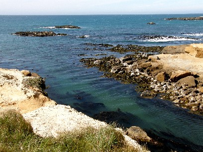 e time in New Zealand is getting shorter steadily, but from the heading here you can see that Eef and I are here already for a while. We want to shorten the trip to Christchurch a bit, so we donít have to drive too far the last couple of days, so our first stop today is 220 north of Dunedin. We wake up after a short night and still see the albatross and the beautiful heads of the penguins if we close our eyes. The night was particularly cold. Timo woke up first and saw that at 07:00 it was only 6į. Luckily this is Celsius and not Fahrenheit. Eef does not want to get up yet, but when Timo says the weather is nice and starts to get warmer (already 10į warmer now than one hour ago) and only then sheís OK in getting out of the camper. Today there are only two stops scheduled: one for penguins and one for Moeraki Boulders.
We have breakfast with the coffee that Eef took from the camping kitchen yesterday. In the kitchen are a couple of dispensers with salt, coffee and sugar. Eef took some of the coffee and put it in our cup, because ours was empty and we want to be able to drink some coffee. The sun is now present and the day starts sunny. Maybe it will stay like that the whole day. After our breakfast that is later than usual we leave from the Aaron Lodge Top 10 Holiday Park. What a mouth full. First we buy leave to roll cigarettes, because we ran out and then we leave town. There is nothing much to say about the road out of town and the first kilometers from Dunedin. We drive on a highway through the hills. Green ones, youíll think, yes indeed, with many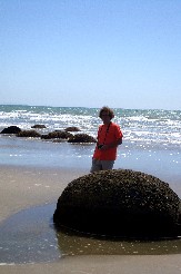 sheep on it? Yes indeed. Thatís the road from Dunedin to Christchurch, the HW 1 all the way north and going up and down. We move quickly and Tourism Radio (yes them again) say there is a point worth to stop for at Shag Point. So we drive over a small road and arrive on a big parking lot. Here we see seals and even after the close encounters of the last couple of days itís always nice to see these animals. Itís too far away to take good pictures, so we only photograph the landscape. The beach is beautiful by the way.
With the camper we are normally not allowed to drive on to the next stop, but we try, because the road looks good and itís not far. There is also a seal colony and yellow-eyed penguins. We see many seals, but no penguins. You need to be very lucky to see one coming to land at this time of the day. Back to HW 1 to Moeraki. This is a small village along the highway. We donít stop in the village, because weíre here for the Moeraki Boulders. On the beach lie many large round boulders of which the origin has not been discovered yet. And if you see how the tourists act here scientists have little time to find out. Everybody walks on the boulders and hangs on and over them, only to be in the picture with this special creation of Mother Nature. We donít do that, because we just want to enjoy the view, the boulders and the beach. On our way back someone speaks to Timo: Here are the Belgians again. And indeed: Sabine and Django are here too. The last time we saw them was on the Interislander. They have not been diving anymore, but enjoyed both of the sounds in the south.
We do a walk on the beach and weíre happy that weíve stopped here for the Boulders. According to Tourism Radio this is one of the most fantastic thin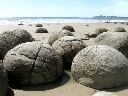 gs in the area, but yeah, they say that about more things too. We drive off and start to get hungry, so we want to stop along HW 1. We do this at Wai-Iti Park. The name sounds better than it is, because this is only a stop next to the highway. We stopped just earlier in Oamaru to buy groceries and withdraw money. Just for tonight, because tomorrow weíll go out. We also tried to get to see the blue penguin in Oamaru, but the only thing they can offer now is a tour to the nest boxes of the birds. In the evening they would be able to offer us the rush back to the nests on the beach, but thatís only about two hours before sunset. We donít want to wait that long, so we drive off on the HW 1.
From this point the landscape looks different from what we are used to. We have seen a lot of different types, but not yet this. A very, very large plain with in the distance the peaks of the Southern Alps and of Mount Cook. And when I say in the distance, I mean far away, because we can hardly see the peaks. Today would have been a good day for a helicopter flight over the glaciers and Mount Cook, but we already did the scenic flight. So we drive on to Timaru. There is another Top 10 with the IAC wireless and we need to surf for half an hour more, so weíll be stopping there. The way to Timaru is nothing special, the whole time a straight lane between fields and sheep. There are many sheep here, we did not notice that yet J. So we drive for another hour and at 16:00 we reach Timaru. We find the camping quickly and this one is as cheap as the ones on the North Island, have e beer en do a walk to the center. There is nothing much to see here anyway. Along the cliffs, to be honest not really cliffs, we walk to the center and stop at Bay Hill. That is a bar with a terrace in the sun and we have not been on a lot of terraces this vacation, so we take advantage of this now.
We drink two pints: a normal lager and a Red, that last one is a bit darker and has a bitter taste. I think we also had this one in Kaikoura. We like it sitting and drinking in the sun and enjoy the moment. The whole day the sun was shining. In the morning it was cold, but the rest of the day was great. On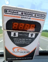 the news we now here there was a second explosion in the mine at Pike River. Everybody is watching the TV and is totally surprised. It has made a big impression on the population of New Zealand. We speak about it, but to be honest (shame on us), we are not bothered about it. Itís really a very bad thing for those people and their families, because probably nobody will survive.
We walk back to the camping and have a beer, chips and then Eef takes a shower. The sun has disappeared behind the clouds, so Eef does not want to stay outside any longer. Timo finishes the report and then also takes a shower. Then itís time for dinner and we cook in the kitchen. The stove in the campervan has not yet been used, just once to light a cigarette, when we could not find the lighter. We did not use the shower either, that was something that was clear from the beginning. In every holiday park there were showers and you pay for them, so you can use them too. The showers and toilets were clean and well maintained, so that not a reason to shower in the van. Letís eat. Today we prepare calamari with three flavors, but they are being cooked in one pot, so that becomes one flavor. With pasta and noodles it tastes very good. Then a glass of wine on the balcony in front of the kitchen and talk about our trip until now. The last couple of days will not be that impressive anymore, so we need to enjoy what weíve done so far.
Itís almost the time when the kitchen is closed, so we return to the camper, have another cigarette and then go to bed with a bit too much wine, but we wonít have problems tomorrow. The ducks on the camping have already gone to sleep, so we do too. Goodnight, almost the last night in New Zealand.
Day 26: Thursday November 25, 2010: Trip to Akaroa on Banks Peninsula
Today is the last full day in New Zealand. Tomorrow we need to arrange the last stuff and prepare a trip even longer than when we came here. The stopover is now first in M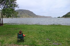 elbourne and then Hong Kong and then London: it takes 24 hours from Melbourne to London. We need to worry about that only as of tomorrow and the day after. We try to enjoy our last say here. Timo wakes up early in the morning and is reading some of the reports and making corrections and looks at the pictures of the last weeks. It has been great so far; I canít complain. Quickly send an e-mail with the minutes we have left from the IAC wireless and then Timo waits a bit longer until there is some more movement on the camping site. Breakfast, then prepare for the last day and start the trip for a bit over hundred kilometers to Akaroa. That town is located about 80 kilometers from Christchurch, so thatís ideal to leave from there at about ten and arrive at the airport around noon. We need to make sure we receive some money back for the two days we lost with the brake problems.
We leave with everything in the campervan and follow the HW 1 to Christchurch. We pass a few small villages, but there is nothing to see there. Tourism Radio is silent except that they are still referencing Shantytown and Arrowtown even though weíre far away from that. We stop in Ashburton, but also here there is nothing to see. We continue the HW 1 to Christchurch. At on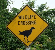 e point on this trip the view is great and so we stop for a few moment. We drive on a plain the whole day: Canterbury Plains. The landscape is flat, really flat and on our left side we have a view in the distance on the Southern Alps and Mount Cook. Itís only about 100 kilometers like the bird flies, but still we see the mountain peaks. Again this is a marvelous view. Iím repeating myself, but the snowy peaks of Mount Cook have a special attraction, especially here. There are many meadows with sheep and crops as well. Where have we seen any sheep before?
We have a constant speed of 100 kilometers per hour, so weíll get to our destination today. At Rakaia we take a different route than the HW 1. We drive through small villages and use the HW 75 after a while. The landscape is still the same as before: flat meadows with sheep and cows grazing along the road. Via Taitapu and Motukarara we reach Lake Ellesmere. This is a wide but shallow lake. We want to stop here for lunch, but canít find a nice spot. There is plenty of life here and especially birds. Timo recognizes some: dozens of black swans, ducks, gulls: it must be nice to stop here. After Lake Ellesmere we see another lake: Lake Forsythe. There is a nice picnic spot, so we stop here for lunch. We eat all the leftovers and have something to drink. The views are great. The plain has made way for spring-green hills. Weíve seen those in the thousands during this trip, but every time itís beautiful to see them again. The slope of the hills is special, like it has been crafted by God himself.
We remain here enjoying the view and then start the last 30 kilometers to Akaroa. Once we passed the lakes the road climbs and descends and then we reach the old remnants of a volcano. Weíll see a picture later on of Banks Peninsula from the air and then you can clearly see this was a volcano. In the village Little River we choose Barrys Bar. We can already spot the bay where Akaroa is located at the other side. We like it as our last stop, because this is beautiful. This part of New Zealand has been occupied b y the French and then returned to the English after some quarrels, but you still see the French influence here, especially in the naming of the villages. We drive through Duchauvelle and then after some more climbing we reach Akaroa. Itís not yet three in the afternoon, so we still have a long day ahead of us. We check on the flight hours if they havenít change, because also here they have IAC Wireless. We better would have checked this in the beginning of the trip, then the wireless connections would have been better. But yes, we know this now.
In Akaroa we find the Top 10 via a steep road and we know for dinner this will be the descent and climb weíll need to do. The weather is great, so we do a walk down to the center. The walk is on a small path down, it does not follow the paved road, but only after ten minutes weíre already in town. We look for a place to eat for tonight in the center and we see that there are restaurants enough to choose from, so we just continue the walk and enjoy the view. We are in a bay that is almost completely round. Up in the hill we have a great view on the bay and the village: itís a nice last stop on our vacation. If you do this as a first stop on your travels, there is plenty to take with you in the camping kitchen. People leave a lot of things here that they canít take home with them. So they leave it on the camping with an indication: free to takes. The Dutch people feel at home right away.
In the village there are lots of things to see, but primarily weíre thirsty, so we first have a drink. Of course this is not our first action, because Eef wants to buy some presents for Maurits and Betty. Timo also takes something for Linda and then in the end we can have a drink. With the view on the harbor itís nice to be here, but the sun has disappeared behind the clouds and it starts to get a bit chilly. We return to the camping and the last couple of hundred meters we need to take the steep track. We arrive rather quickly and have a drink, because we got thirsty from the effort. We stay in the park and Timo starts the least nice task of the vacation: pack the luggage. Really not in the mood, but he needs to do it. He takes the dirty laundry and throws it into the suitcase packed in separate bags and then the rest that is still clean can go on top. Most of the clothing will need to be washed anyway, but that is a worry for home.
It starts to rain, so the mood is going down, just like the drops of water. A small amount of basic tasks after packing: all brochures need to be checked and Timo throws away what he no longer needs and keeps al the good stuff I a plastic bag. Itís the evening of making arrangements and that is no fun, but it needs to be done. Thatís part of traveling life. Eef then takes a shower; Timo leaves that for tomorrow, so he can enter the plane fresh 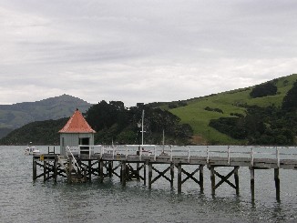 to get off less fresh. The last pictures are being saved on the laptop and then we have dinner, back down to the center. We thought we could afford to go out to eat the last night. We had not done this a lot, so we think weíve earned this. We walk to the restaurant that we saw this afternoon, but itís very expensive. So we walk to another one and check that one out. It is as expensive as the other one, but we donít go back there.
We get a table with view on the coast; that is for Eef, because Timo has his back turned to it. He does not mind, because itís getting dark anyway, so we canít see anything anymore. We prefer a bottle of red wine and have a seafood platter and a seafood risotto. Itís very good and served with those big green pickled mussels. During shopping we saw those often, but had not bought them, because they were expensive. Now on the last night we can still taste them and itís very good. It was with the seafood platter and everything is nice, also the risotto Timo has. The dishes are big, but then weíll fall asleep easily.
Itís dark when we return to the camping and walk up the track again. Its not that difficult, although the manager of the park told us the way up would take long. After less than ten minutes weíre in the camper. We can enjoy the great view. Weíre on top of the bay and see the lights of the village and itís magnificent, really unbelievable. We smoke a cigarette and drink some wine and then lie in the van. We look at the pictures of today and the previous days and then we have discovered something very nice. We lie in bed and through the back door of the van we can watch the starry sky and the village of Akaroa in front of us. We really enjoy our last night here. At about 22:30 Ė already that late Ė we put off the lights, use the insect repellent and then go to sleep.
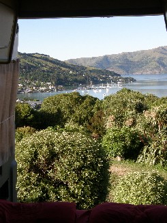 Day 27: Friday November 26, 2010: Departure from Akaroa, New Zealand
Today is the final day. We leave this morning from Akaroa, this afternoon from New Zealand and then from Oceania, Melbourne Australia. The weather is nice, so getting out of bed is not that difficult. The packing is less pleasant, but Eef packs all her things, Timo packs his backpack and puts some more stuff in his suitcase. We sort out some more of our paperwork and then prepare the vehicle. Our breakfast consists of only leftovers and then we clean up everything and prepare the campervan for the return to Apollo. We put the seats back to their starting position and now we see how big the van is, without the bed in the back. We also enjoy the view we had here and take some more pictures of the bay. It is really very nice, a good spot to close off the vacation. Yesterday we could still enjoy the evening and night and now with the rising sun itís equally marvelous.
A few minutes before ten we leave the holiday park. During the last 85 kilometers we try to look at the scenery that we saw during the four weeks and now it has a special touch to it. Suddenly Eef says: Hey T, weíve been driving here for 25 day, huh. And indeed it has been beautiful and great. I even think this will get clearer when Iím home for a couple of days or weeks. We drive to Christchurch without stopping: there is one stop only and that is to fill up with diesel. On about 20 kilometers before the city we stop and then move on. A real stop is not the right description for it. We donít drive too fast, because we donít want to have any accidents on our last day. We locate Christchurch easily, the airport has already signs to it, but the rental is close, but not on the ai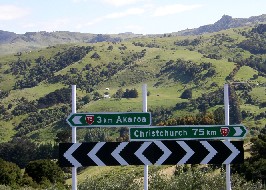 rport itself. Eef tries to find a shortcut, but that does work out fine. Itís not because Eef canít read the map, but rather because the map is very bad. Eventually we return to the point where the airport was indicated; weíve been here before and then follow those signs. Three intersections further we suddenly see the street where we need to be.
Yes, this is the right place. We turn off here and the third street (actually the second) on the right side is the one we need. There we quickly find the office of Apollo, but there are no signs, nothing is indicated in any way. We check out and Timo is too honest to say the table is broken, but also wants to insist that we need to get a refund for the two lot days. Their proposition is 105,50 NZD for the table and then another 80 NZD for the lost days. We should get 185,50 NZD back, but because of the price of the table Ė is it antique or what? Ė they will reimburse the 80 NZD to the MasterCard. Is this OK for you? I think we donít have a lot of choices, so we accept the proposal. Weíve already forgotten about the incident, but we think itís disgraceful that they ret a car that needs repair the second day already. We try to get more out of it, but itís either that or nothing. It not the way it should be, but well.
After 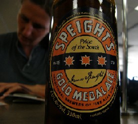 the arrangements they bring us to the airport and ten minutes later weíre there. We check if we can already leave the luggage at the check in and that works out, which is nice. At the check-in there is a young guy, starter at the job and he does not know where Brussels is. We get one boarding pass and itís not certain if the luggage will make it to Brussels with us. Bad luck if it doesnít. But weíre going home, so there is no issue. We head for the restaurant at the first floor and have a hamburger and some fries, because we have no idea when weíll have something to eat again. Then we try to spend the last NZD, buy a few T-shirts and key rings and then itís finished, actually one Dollar short, but the lady gives us that from a jar she keeps for these occasions. Thatís very friendly. Thanks a lot and she replies: No Worries! We get everything at duty free prices, so itís cheaper and the goods will be delivered after customs and luggage control. That is something new. The unemployment grade here is very low. We donít need to wait long anymore Ė countdown is at 22 minutes now Ė and then we can board. The flight takes a bit over three hours to Melbourne, then weíre stuck there for a while and then we fly via Hong Kong to London. By now weíre already in Melbourne, have had a beer and are resting a bit, because itís two hours earlier than in New Zealand and we already felt the jetlag. Weíre on our way from ten this morning, itís now 20:00 local time and weíre still on the other side of the world. That will get better later on. Now weíre sitting here for about four hours. We try to keep busy and rest a bit, but thatís not very easy.
Departure time was 23:55, but that changes two times. Luckily we were able to sleep for a few hours, but not very deep. The bars are closing down and the shops too. Boarding had to start half an hour ago and nothing is happening yet, so we fear we wonít leave on time. A bit before departure time they announce that actual boarding will start at 00:40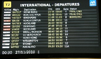 , because there is a technical problem. That's not funny. Before closing time of the bars we spent our last Australian Dollars. Eef had changed 50 Euro and we drink some beer at gate 4 where the plane should leave shortly.
Day 28: Saturday November 27, 2010: Australia, Hong Kong, London, Brussels
Local time changes to Saturday in Melbourne Australia. Itís just after midnight and we havenít departed from Australian soil. The flight has a delay of almost two hours. Luckily Australians are not having trouble with night flights; otherwise they should have provided a hotel. They donít do that, but fix the technical problem. There was an issue with the hydraulic pump of the landing gear, so Qantas ensures that everything get repaired and we can board two hours after normal departure time. Now we can spend our time in the airplane. In the meantime itís 01:30 Australian time, for us this means even two hours later, but hopefully the plane is easy to get some sleep. Weíll see about that when we sit, lie or hang there. Weíre not in a hurry to get on board, because that will be our seat for the next 8.5 hours. We have the same seats in the aircraft 56B and 56C, so we know our way around. The amazing thing was that we did not receive a boarding pass in Christchurch to fly all the way to Bru ssels. We checked in all the way and the luggage too, but we did not get a boarding pass. Eventually just before departure we get one together with about ten other people. Weíre on the aircraft, yes.
We take our seats and need to wait for another thirty minutes before we take off. The technicians are still filling out the necessary forms and as a consequence the delay is more than two hours. You canít change anything about that huh and it cuts down on our waiting time in Heathrow, which is a good thing. Weíll see what happens. In the end we can take off and Qantas apologizes a hundred times for the delay, but we donít mind and you canít change it either. We immediately receive a small bottle of water and after 45 minutes of flight we already get dinner: twice cooked pork in a spiced master stock with fragrant rice. It sounds better than it tastes. As long as you get something to eat. Everyb ody tries to get some sleep after everything is cleared. Timo sleeps about four hours and the lady next to him almost the whole time. How she does that is a riddle.
If you can sleep for four hours, time is going fast, because there are only two hours left. There is still a continental breakfast, so that accelerates time again. Weíre in Hong Kong now after a flight of almost nine hours and it is very clouded here. Suddenly there is a bump of the landing and weíre there Ė we did not even notice we were flying that low already. Now we need to get off, follow International Transfer. We arrived at gate E 15 and need to clear customs and then return to gate E 15, a level up for departure. But the first thing we do is something else: Timo has seen a smoking area. Behind one of the bars you can quickly smoke a cigarette. You can say of Hong Kong and Thailand what you like, but here they have considered smokers. That was not possible in New Zealand or Australia, nor the United Kingdom. There were no smoking areas at those airports, also not in Melbourne where we were stuck for half a day.
We see that the atmosphere is special, because everybody if running around with masks Ė as expected - and after a cigarette we walk to the transfer terminal. They havenít started boarding yet, but first we need to pass hand luggage check, although thatís the third time already, but they still need to have it done. Let them be. After the check we wait for ten minutes to board and Timo can use the Internet for free for a while. Cool, well done Hong Kong Airport. Then boarding starts and  we can take our seats again, just like the previous nine hours. Eef notices that there are some empty seats at the right side, so she takes two seats and leaves another two for an older man. So Timo has also two seats and the British lady next to him can take some more space too. We fear Eef canít stay there, because boarding I not yet finished, but Eef pulls it off. We all have a benefit of it. This is a flight of TWELVE hours and FORTY minutes (!). We have never been that long on an airplane; that is really very very long. We donít think about it, because then we have another flight of one hour.
Also here we have a delay of half an hour and then another twenty minutes, because something wrong is in one of the passengersí luggage and it needs to be removed. As if they had not been able to check that when they put it in. So in total with a delay of three hours we leave to London. The waiting time for the connection there has already been changed from five to two hours. If they continue like this we might need to take another flight, then weíll miss the original one. Hell yeah, shit happens if it needs to happen.
This third flight is the longest one Iíve ever had in my life and that is not nice. The first couple of hours are OK, because we get breakfast, just like at the end of the previous flight and that gives some change. Timo canít sleep, maximum fifteen minutes or something, so you canít call that sleep. Then he watches TV, tries to fall asleep again, then yet another film and another one. Then itís time again for lunch, so itís is too bad after all. Thirteen hours on a plane is not really fun. We t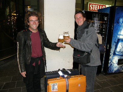 hink itís nice we have an extra seat, so itís a bit more comfortable than three adults in one row. The last meal we get is lunch and most people have fish. The taste is not really good, but it mainly kills time. In London we need to make a tour around the city before landing, because the control tower is not clearing landing yet. Finally weíve made London.
We walk to the terminal for the connecting flights, get on a bus and are being driven from terminal 3 to terminal 5 in ten minutes. There we need to pass hand luggage check again. The backpack of Timo needs to be looked at twice, but all is OK then. So then itís time to have a beer again. At the back of terminal 5 we find the V-Bar and there itís quiet, so we have a Stella, a pint of course. We wait a bit until we see the number of the gate and then we can board for the last flight to Brussels. Itís now 16:33 local time and hopefully we can leave on time. That is the case; we even leave ten minutes early. Of this last flight I donít notice anything. We take off and land and all of the flight is like a blur. I have been awake for way too long. Weíre already awake since Friday 10 AM New Zealand time and now itís Saturday morning five oíclock in the afternoon, so you can calculate yourself how long this is. I donít count the four hours of sleep from Melbourne to Hong Kong. We land ten minutes early and can go to collect the luggage. Amazing the luggage is here and even as one of the first bags, well done airplane-companies: we could not have hoped this. We send a text message to Roel and Jurgen as they pick us up. They have a huge surprise for us: four cold Duvels. Really a good plan guys. We drink them at the exit of the airport and we donít care about the tiredness and the cold. Itís freezing in Belgium. The Duvels are very good and then we go to Bornem to drink another one in Sinte vadde. Really great. Thanks guys to pick us up at Zaventem Airport and thanks Eef for the nice company during this magnificent vacation. Then I go home, because I started to miss Cartouche and heís very happy to see me. Iím also very happy. To all good things there is an end and also to this vacation.